Barnes Ice Cap
Nunavut territory | Northern Canada
Dates of acquisition:
• 2025.08.01 | 17:08:49 UTC
• 2025.08.02 | 16:38:39 UTC
Sensors: Sentinel-2B L1C, Sentinel-2B L2A
Coordinates: ca. 70°N, 73.5°W
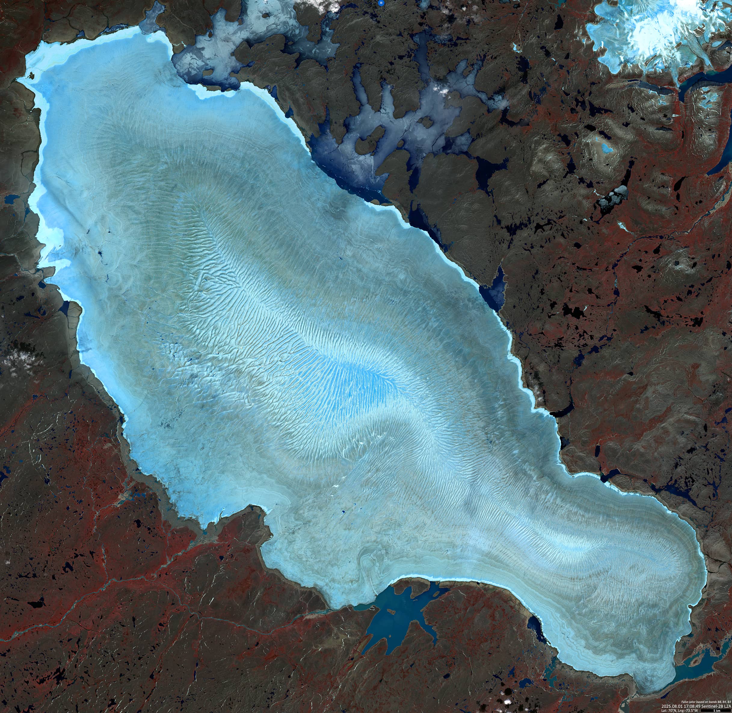
The image shows the surface of the Barnes Ice Cap, the oldest remaining part of the Laurentide Ice Sheet.It is located on Baffin Island in the Canadian territory of Nunavut. Some sections of the ice date back more than 20,000 years, making it the oldest ice in Canada.. The Laurentide Ice Sheet once covered most of Canada and the north-eastern United States. The last glaciation cycle occurred between 95,000 and 20,000 years ago. The Barnes Ice Cap covers an area of around 6,000 km².
Over the past 125 years, the Barnes Ice Cap has lost 15-20% of its total mass. This process is likely to continue.
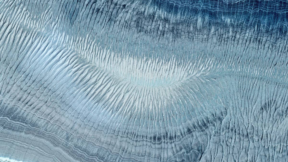
The dynamics of the ice cap’s surface are characterised by higher ice flow ratesfrom north-east to south-west and lower rates from north-west to south-east, due to the slope of the underlying bedrock, among other things. This is particularly noticeable in the central part of the dome, where cracks, gullies and ravines in the ice enable meltwater to drain from the glacier (Figure 1). Precipitation also collects mainly in this limited zone.
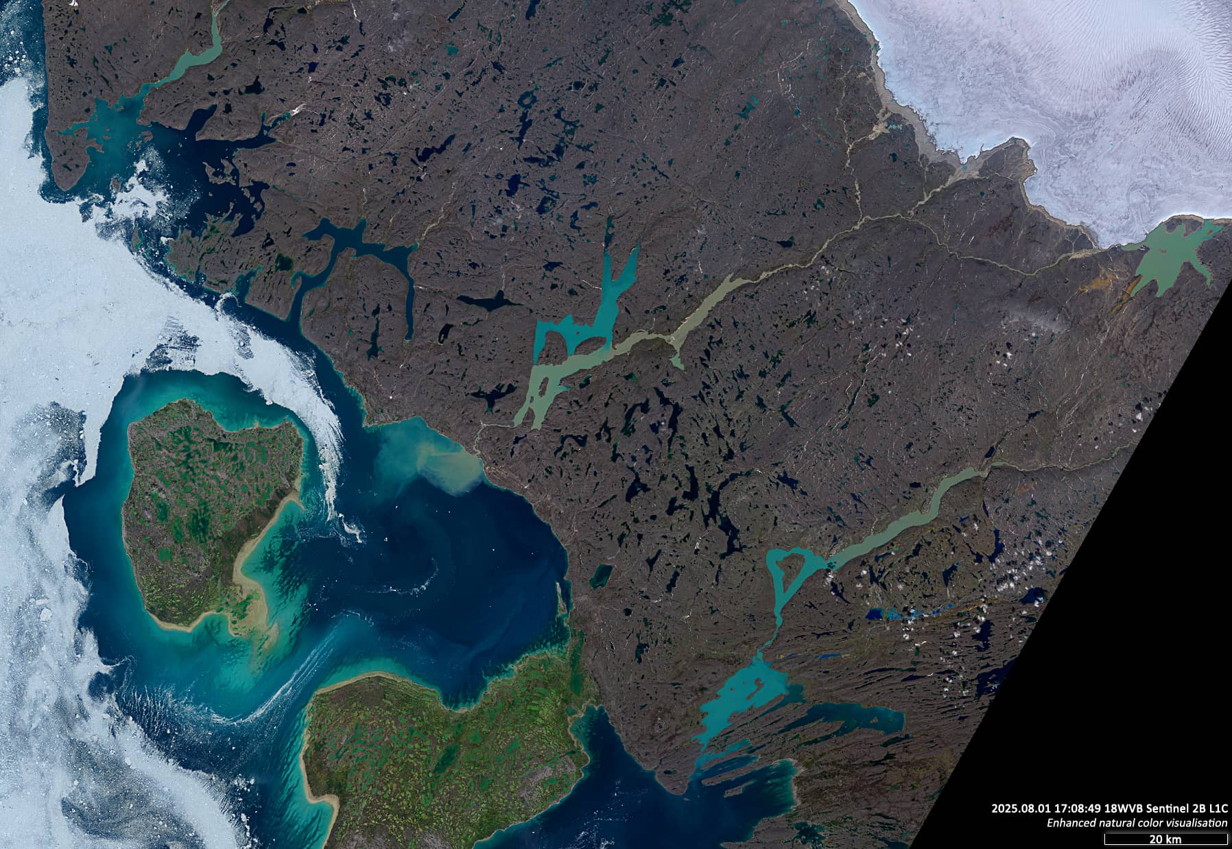
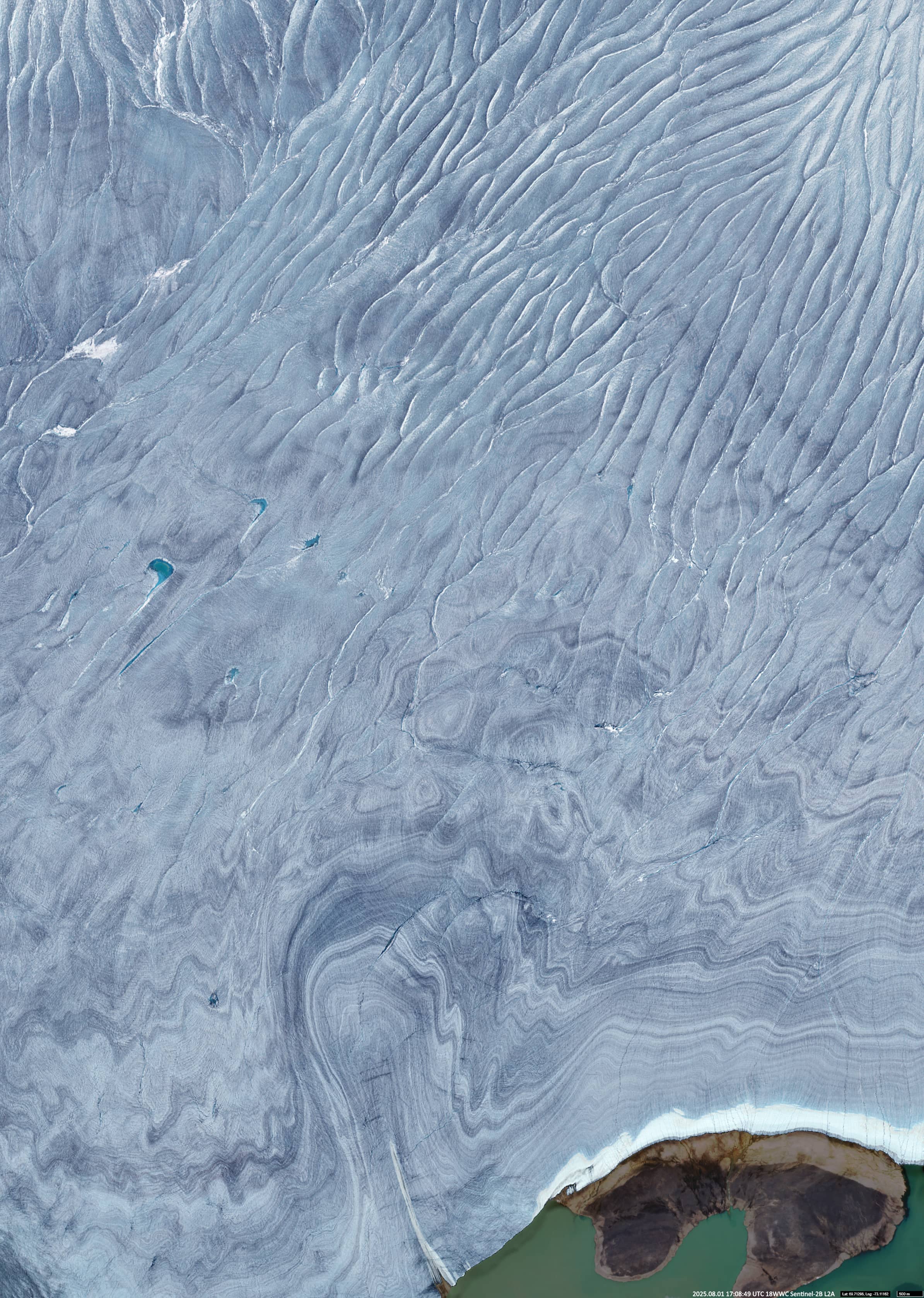
Several small rivers, such as the MacDonald River and Flyway River, etc. can be seen in the south-west of the ice cap. These rivers transport sediment- and ice-coloured waters through the lakes of Ikpik and Nauja Bay in the Foxe Basin, which connects with Hudson Bay of the Arctic Ocean (Figure 2). Figure 3 shows a close-up of the surface of the southern part of the glacier, north of Blanchfield Lake.
Further reading
Barnes Ice Cap (Wikipedia)
Laurentide Ice Sheet (Wikipedia)
Baffin Island (Wikipedia)