Windstreaks of Pali-Aike
East Patagonia | South Argentina
Dates of acquisition:
• 2025.10.18 | 14:17:21 UTC
• 2025.10.13 | 14:17:09 UTC
• 2025.10.05 | 14:07:21 UTC
• 2024.07.14 | 13:57:09 UTC
Sensor: Sentinel-2B, C L2A
Coordinates: ca. 51.4°S, 69.4°W
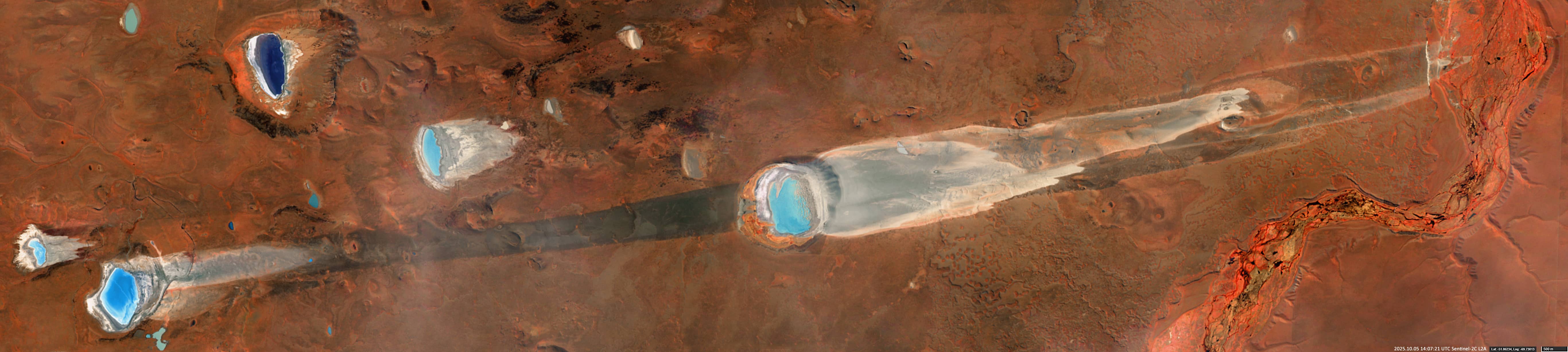
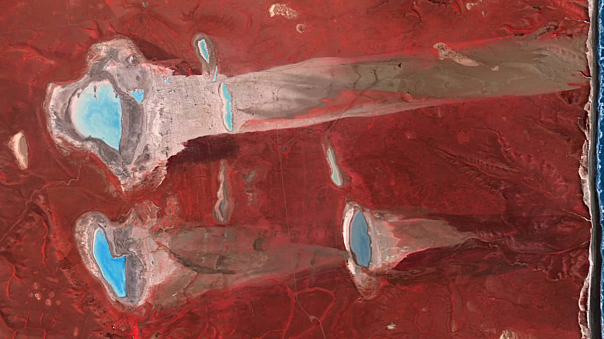
The observed geological structures in this Earth Gallery contribution are the result of eruptive processes in the Pali-Aike volcanic field of Argentina. This field belongs to the Patagonian volcanic arc system, which has been active since the Late Miocene era due to regional tectonic activity. The volcanic complex comprises a large number of maars of various sizes, ranging in diameter from approximately 0.5 km to 4 km.
Maars are broad, flat depressions surrounded by rims of pyroclastic or sedimentary deposits that rise above the surrounding terrain. They typically form where ascending magma interacts explosively with groundwater or permafrost. The periglacial soils left behind by glaciers in this region before volcanism began were rich in ice and water, which may explain the unusually high concentration of maars in Pali-Aike. Towards the end of summer, some of the basins dry out, allowing the wind to erode fine sediments from their bottoms. This aeolian activity results in elongated windstreaks, extending for up to 12 km.
Windstreaks are surface features of aeolian origin, characterised by a contrasting albedo to the surrounding terrain. They are usually elongated in shape, form in association with topographic obstacles and are often found near volcanic craters. While such features are relatively rare on Earth, they are well-documented and much more common on Mars.
In Patagonia, active windstreak development can be observed not only in the Pali-Aike field, but also further south and, to a considerable extent, northwards as far as the province of Chubut. Comparable geomorphological structures can be found up to ≈865 km to the north (see Figures 6 and 7) and beyond.
Figure 1 of the Pali-Aike volcanic field, acquired by Sentinel-2, is shown in summer (including SWIR and NIR bands: RGB[B12, B8A, B4], to emphasise topographic features) and in winter (in the VIS range: RGB[B04, B03, B02]) conditions. Several detailed images (Figures 2–8) also illustrate individual maars and associated windstreaks, captured in false color images including NIR band (RGB[B08, B04, B03]). The structures are easier to recognise in this colour palette.
Notably, despite the considerable spatial separation among these features, the orientation of the windstreaks remains remarkably consistent across the entire observation region, ranging from approximately +10° to +20° relative to the corresponding latitudes in the south, and reaching as low as –10° in the north. This remarkable uniformity suggests that the prevailing wind directions have remained stable for hundreds of thousands of years, probably due to downslope winds from the Andes Mountains to the Atlantic Ocean.
Further reading
Pali-Aike volcanic field (Wikipedia)
Windstreak (Wikipedia)
Crater lakes of the Pali Aike Volcanic Field (Research Gate)
Glacial, fluvial and volcanic landscape evolution in the Laguna Potrok Aike maar area, Southern Patagonia, Argentina (Science Direct)
Fig. 1
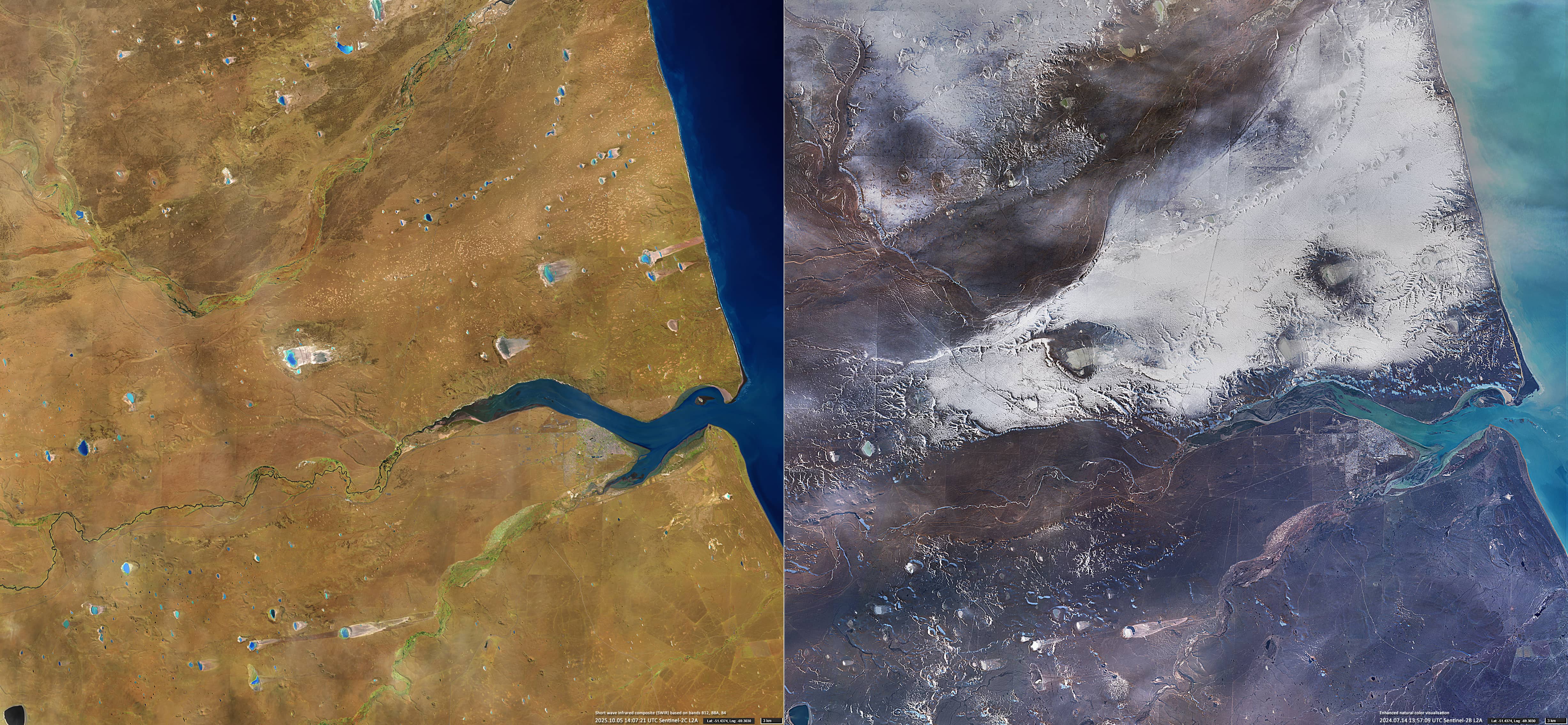
Fig. 2
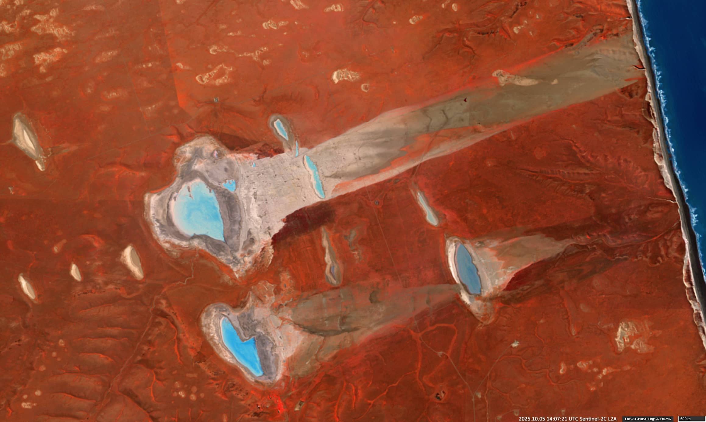
Fig. 3

Fig. 4

Fig. 5
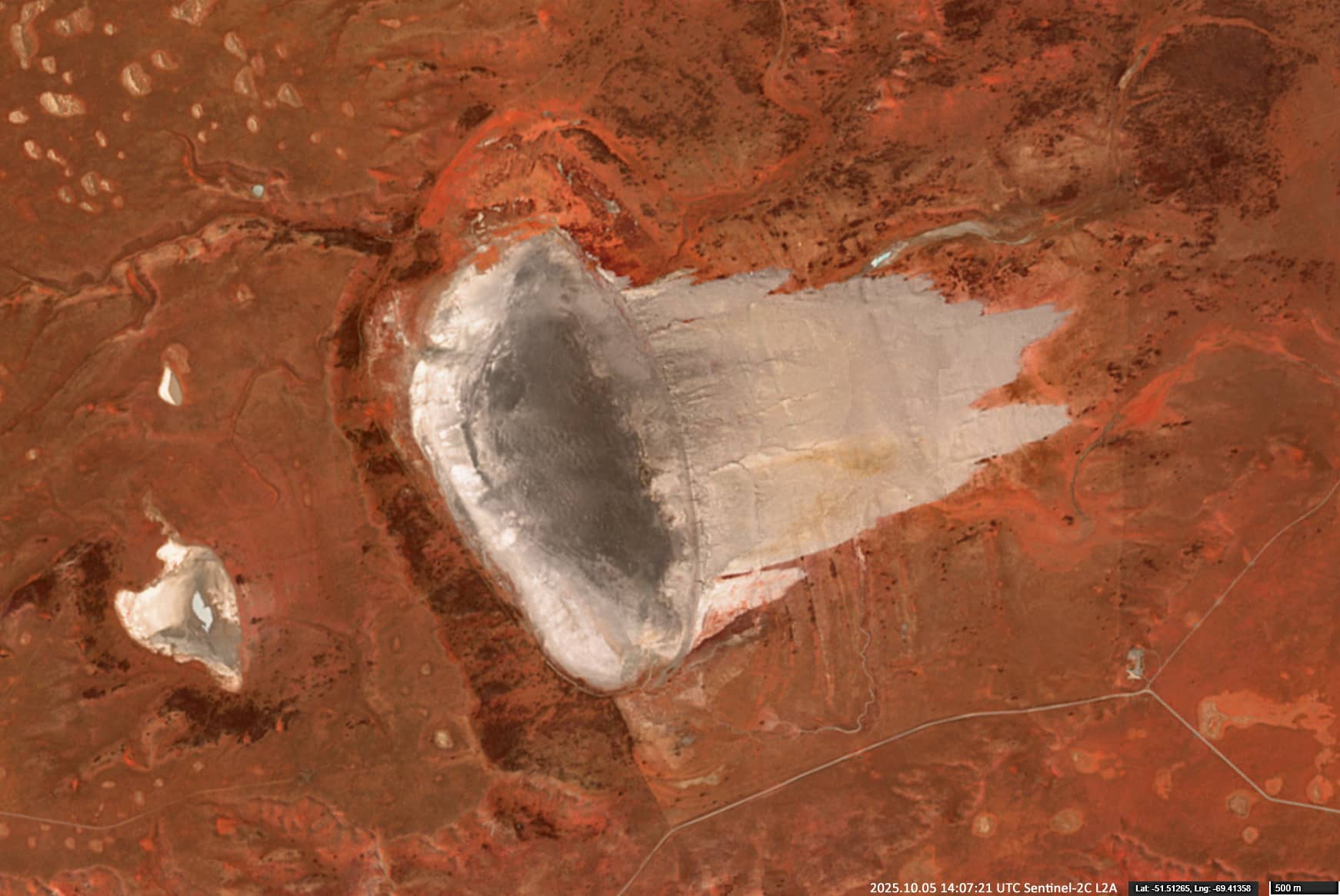
Fig. 6
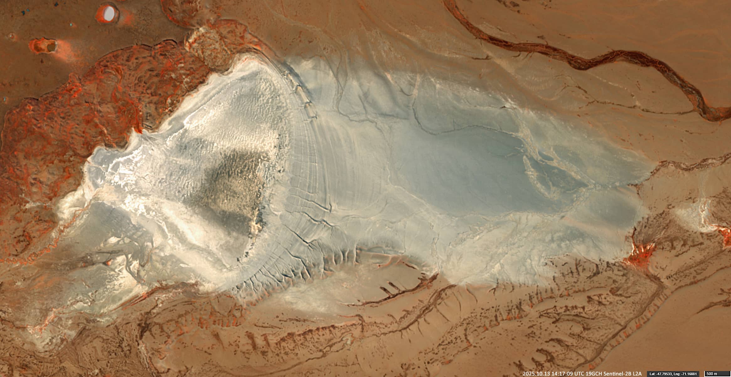
Fig. 7
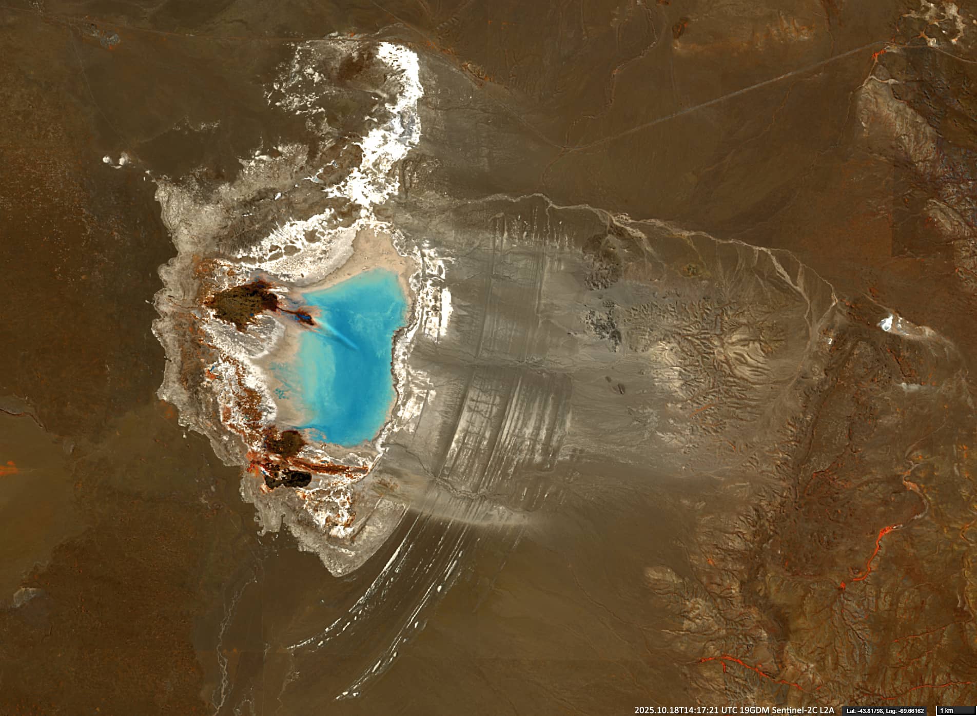
Fig. 8