Tolo Bay
Central Sulawesi | Indonesia
Date of acquisition: March 6th, 2026 | 02:12:09 UTC
Sensor: Sentinel-2B L2A
Coordinates: ca.
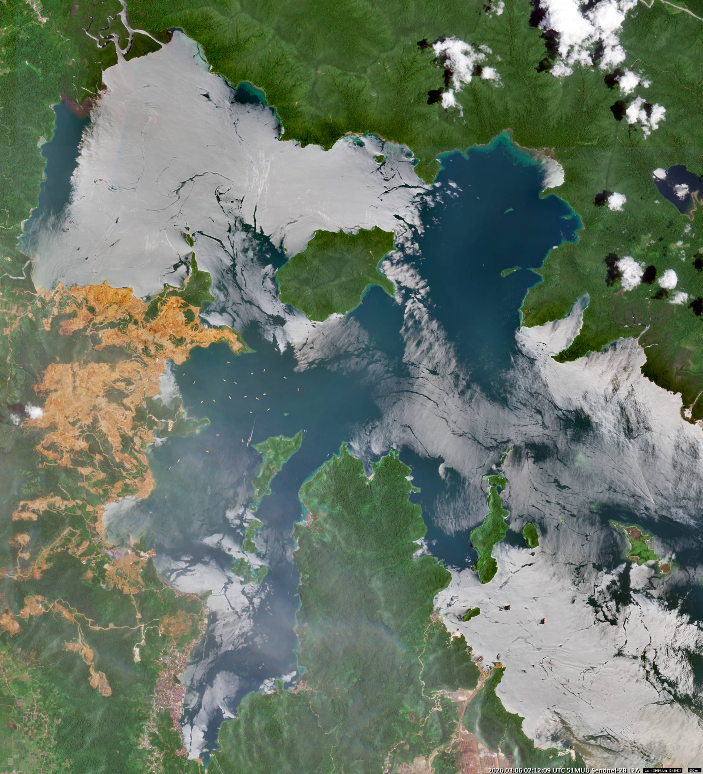
The image shows Tolo Bay (Indonesian: Teluk Towori), which is located in the north-western part of the Banda Sea, between the eastern and south-eastern peninsulas of Sulawesi.
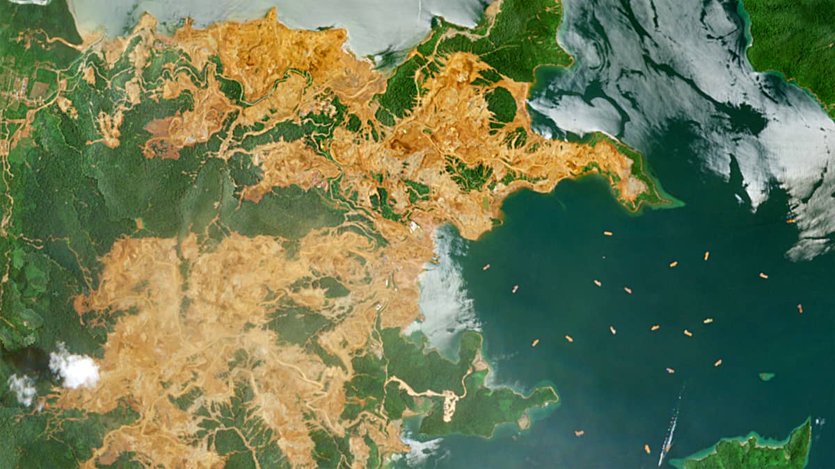
One striking feature is the bright yellow-orange colour of the land along the coast. This indicates a significant nickel laterite deposit, which is formed by the intense chemical weathering of ultramafic rocks in tropical environments. Indonesia is home to some of the world’s largest deposits of this type, many of which are located close to the coast.
The upper layer of these deposits is rich in iron and appears vivid orange in satellite imagery. Beneath this lies a nickel-rich zone containing minerals such as garnierite. These ores are widely used in the production of stainless steel and nickel sulphate for electric vehicle batteries.
Off the coast, a series of rectangular shapes can be seen in the water. These are empty barges waiting to be loaded with ore. Typically measuring between 20 × 80 metres and 30 × 90 metres, they are used to transport the material for further processing and are towed by tugboats during loading operations.
The town of Kolonodale can be seen in the bottom left of the image. It is the administrative centre of the North Morowali Regency in Central Sulawesi.
Further reading
Kolonodale, IDKNL – Indonesia – Real time view of all ships currently in Kolonodale – Indonesia – (VesselFinder)
Kolonodale (Wikipedia)
Gulf of Tolo (Wikipedia)
Mapping of Nickel Laterite Resources Using Geographical Information Systems (Sig), Case Study Koninis Region, Central Sulawesi Province (Research Gate)
Unsere E-Autos brauchen Nickel – doch so verheerend ist die Produktion (Stern, German)
Riesige Waldflächen für den Bergbau gerodet (Spiegel, German)