Yana Bay
Laptev Sea | Sakha Republic, Russia
Dates of acquisition:
• 2025.08.20 | 03:26:01 UTC
• 2025.08.25 | 03:25:19 UTC
Sensors: Sentinel-2B, C L2A
Coordinates: ca. 71.5°N, 134.44°E
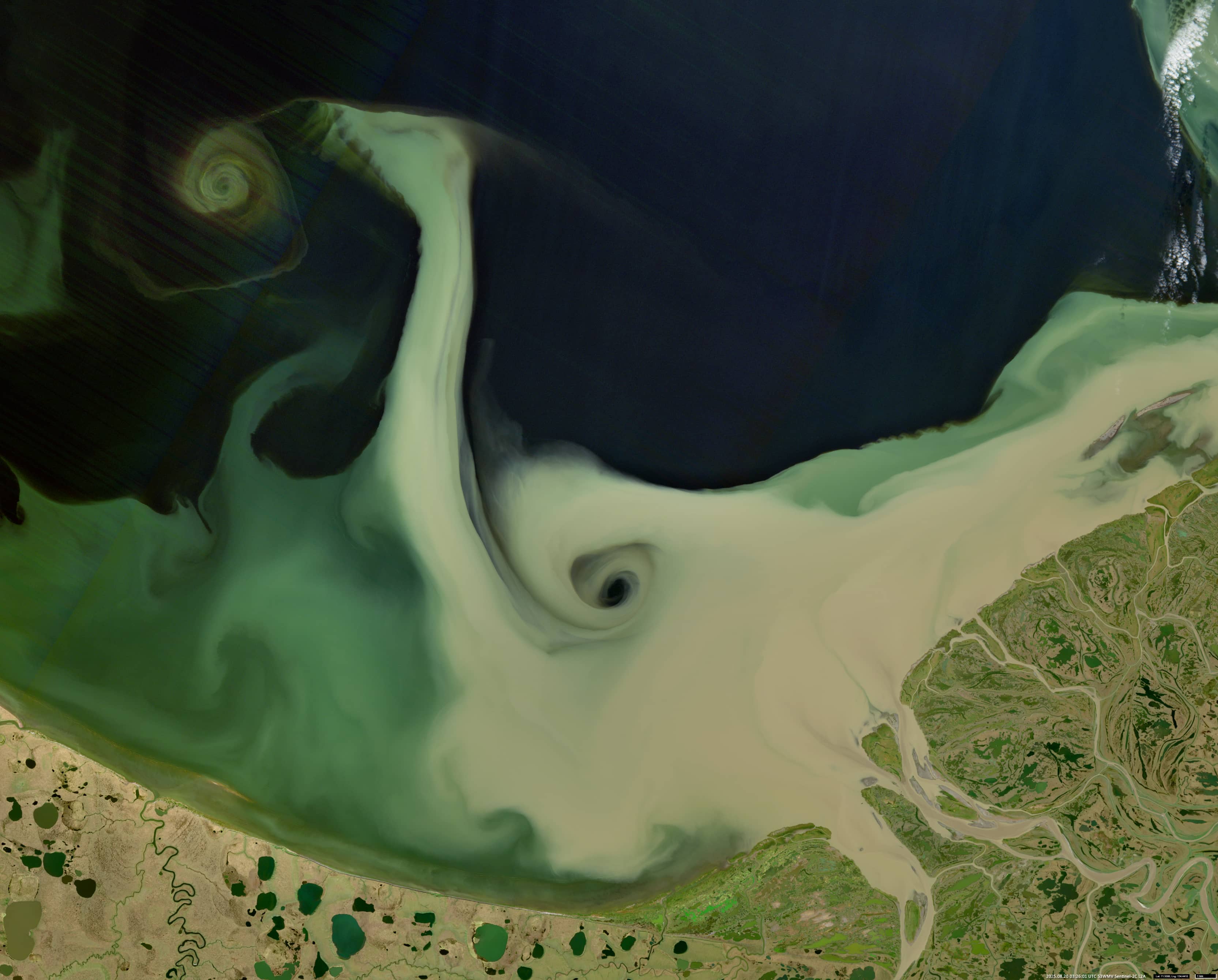
The Sentinel-2 image shows Yana Bay, which is located in the Laptev Sea in the Sakha Republic (Yakutia), Russian: Саха Өрөспүүбүлүкэтэ. It is named after the Yana River, which is 872 km long and flows into the bay from the south, forming a large delta (~10200 km²) at its mouth. The area is about one third the size of Belgium and almost uninhabited and most of it has probably never been visited by humans.
There are also a number of other rivers entering in the delta, including the Buor-Yuryakh River, translated as “clay river” (one of about 50 rivers in Yakutia with this name). It is located in the far west. All these rivers, as well as numerous branches of the Yana River, are ice-free in early and mid-summer, transporting large amounts of sediment from their clay banks into the bay in July and August. These banks consist of permafrost, which has recently been subjected to intense melting.
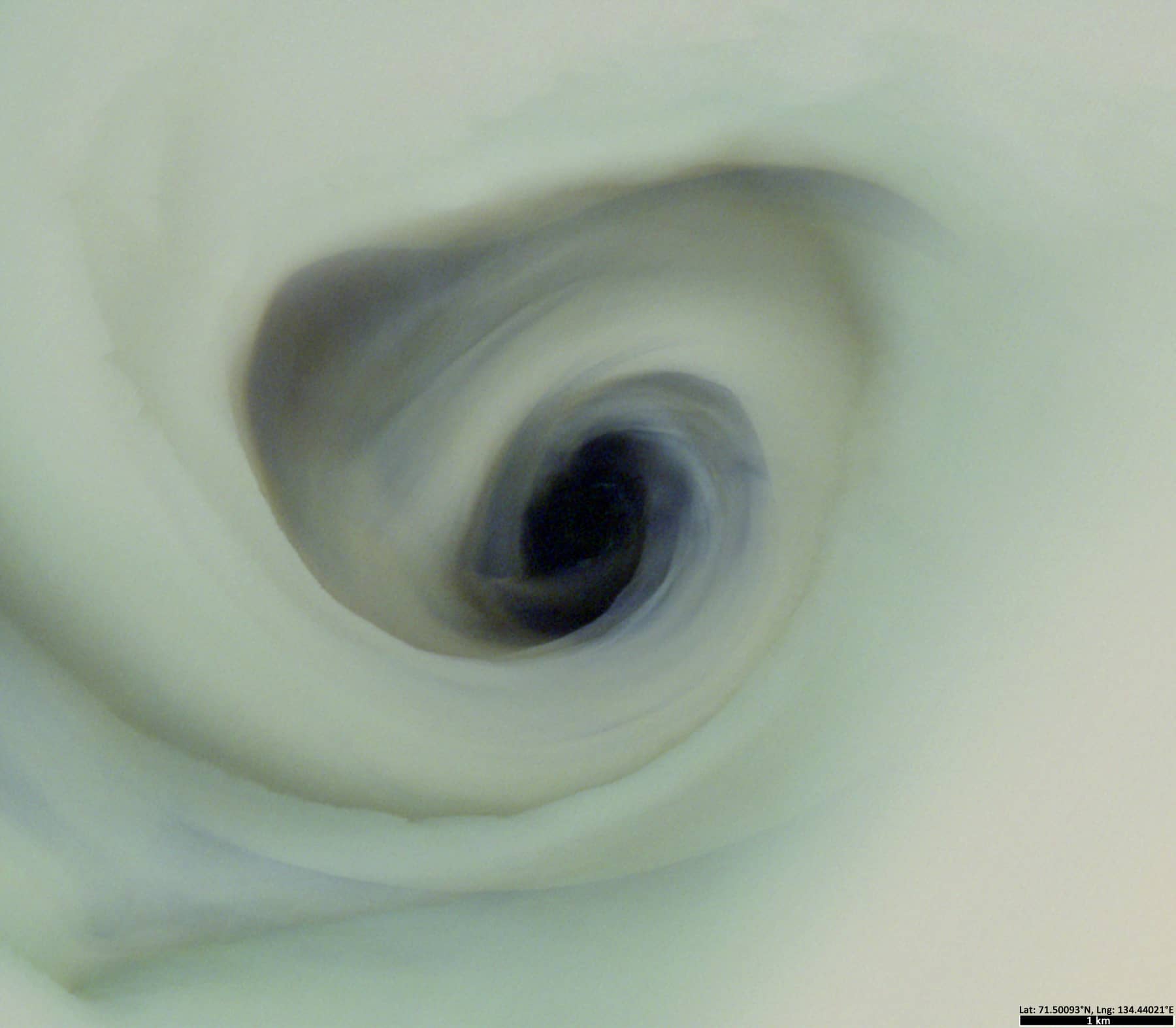
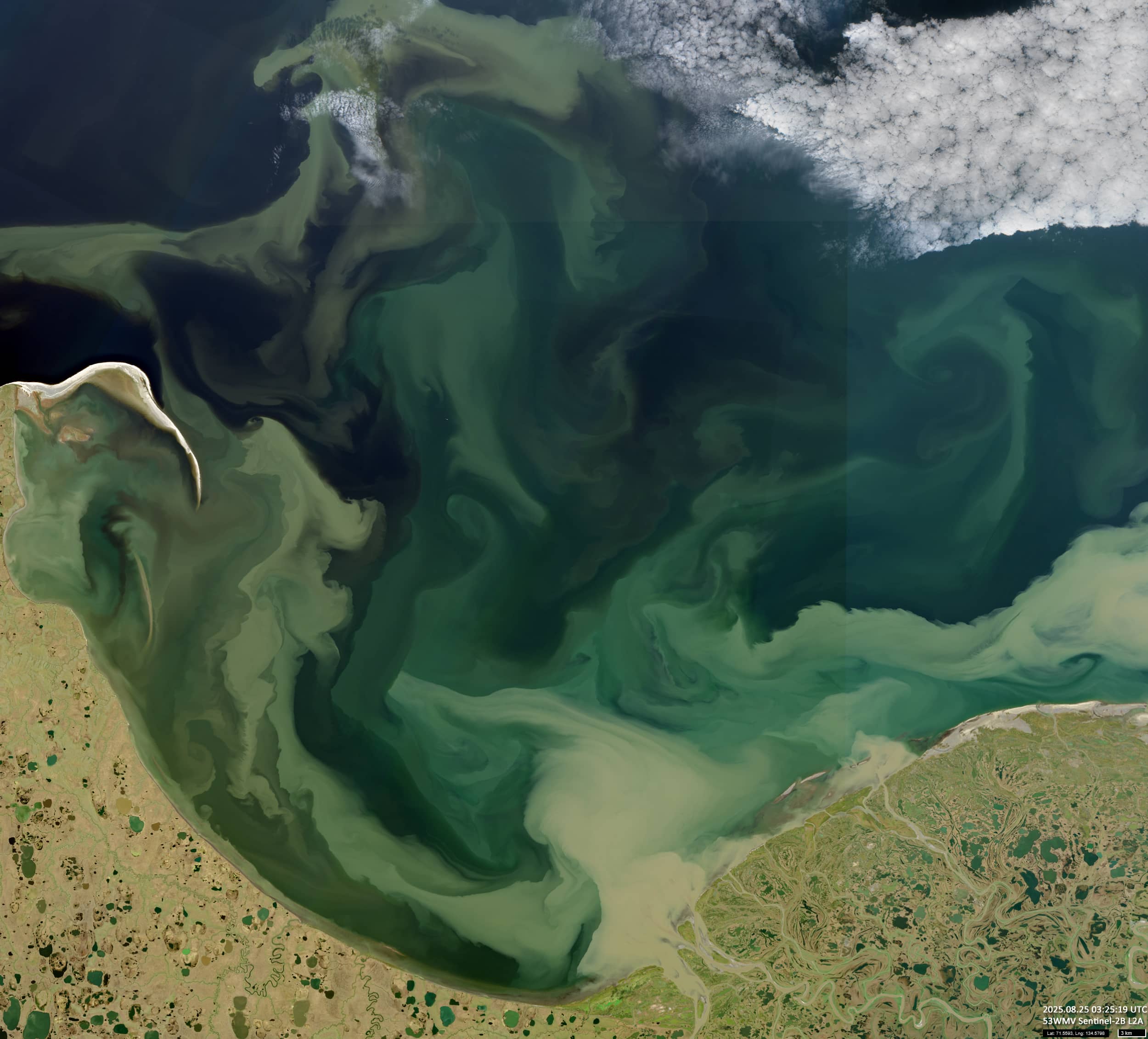
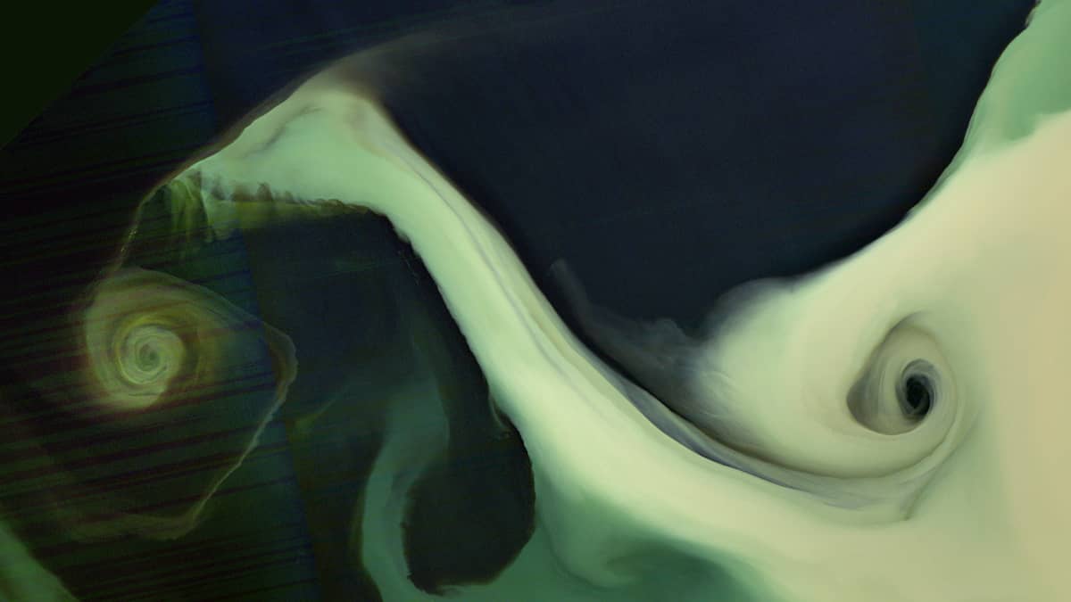
A “fortunate”-shot cloudless satellite image shows a remarkable, seemingly deep-going eddy of heavily sedimented water (Figures 1 and 2). An additional image (Figure 3) showing the situation in the entire bay a few days later – it is still there.
Interestingly, a 32000-year-old Homo sapiens site was discovered 120 km from the mouth of the Yana River – the northernmost Upper Paleolithic site (71° N).
Further reading
Yana Bay (Wikipedia)
Yana (river) (Wikipedia)
Yana Rhinoceros Horn Site (Wikipedia)
List of European countries by area (Wikipedia)