El Estuario del Río Quequén Salado
Buenos Aires Province | Eastern Argentina
Dates of acquisition:
• 2025.03.13 | 13:47:31 UTC
• 2021.01.13 | 13:51:11 UTC
Sensor: Sentinel-2C L2A, Sentinel-2A L2A
Coordinates: ca. 38.93°S, 60.5°W
The Rio Quequén Salado is a small river in the southwest of the province of Buenos Aires in eastern Argentina. It is about 155 km long. The catchment area is about 10,000 km².
Its source lies in an intermontane area between plains and low hills. This area is often prone to flooding during heavy rainfall because the terrain is gently sloping and the infiltration rate (the speed with which the soil can absorb water) is very low.
The soils of the riverbed are clayey and loamy, with calcareous horizons coming to the surface in the river channels. In deep gorges, the river crosses aeolian and fluvial-lacustrine horizons of sediments; thick layers of gypsum canalso be observed. Near its mouth, the river flows along a coastal dune belt before emptying into the sea to the east of the seaside resort of Marisol. There it remains at a depth of two meters and ensures the exchange of salt and fresh water in a complex and dynamic estuary.
This description of the course of such a small river helps to understand the composition of the sediment it carries into the Atlantic.
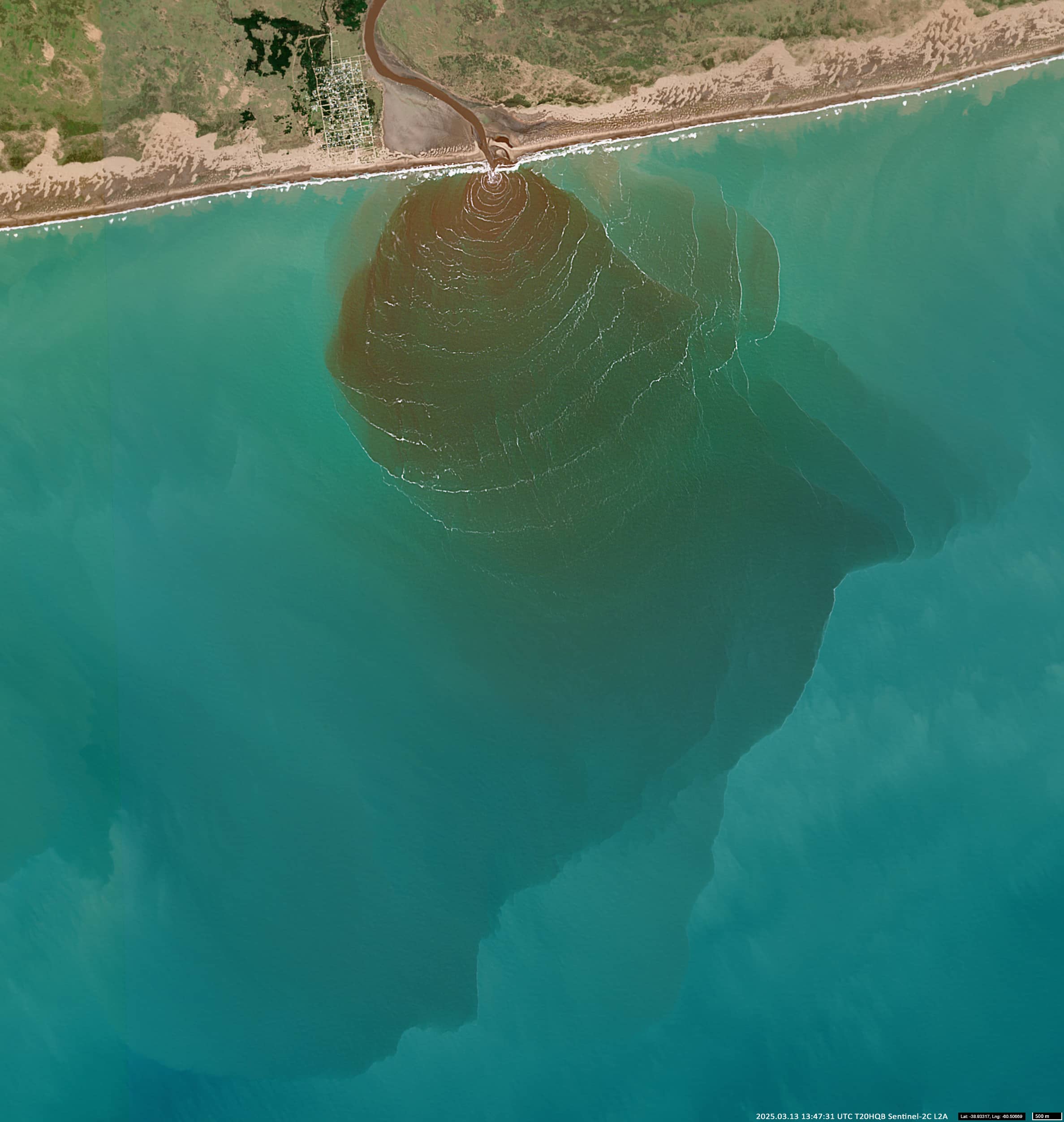
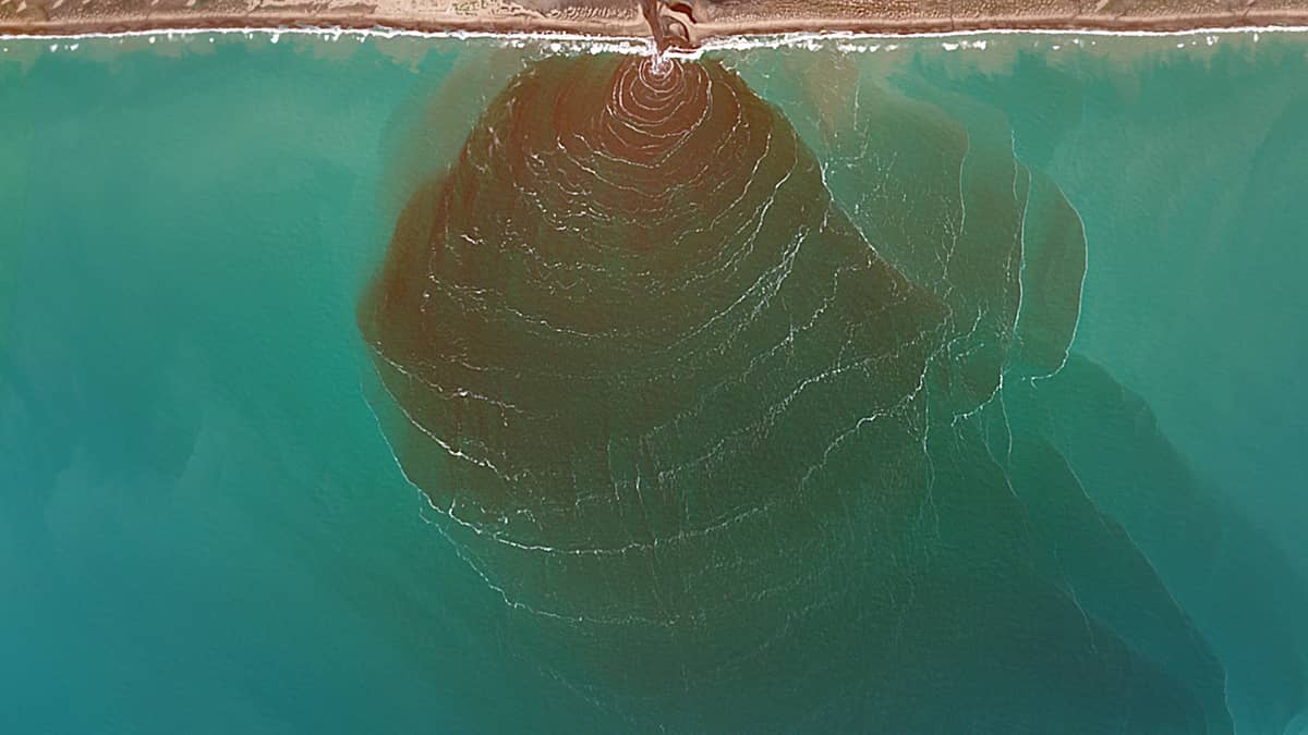
The situation shown in the Sentinel-2 satellite image is a rather rare event in which a large amount of yellow and brown sediment is carried out to sea in a circular plume with a diameter of about 6 km and an area of about 28 km2 (Figure 1). This event occurred after intense rainfall following a period of drought.
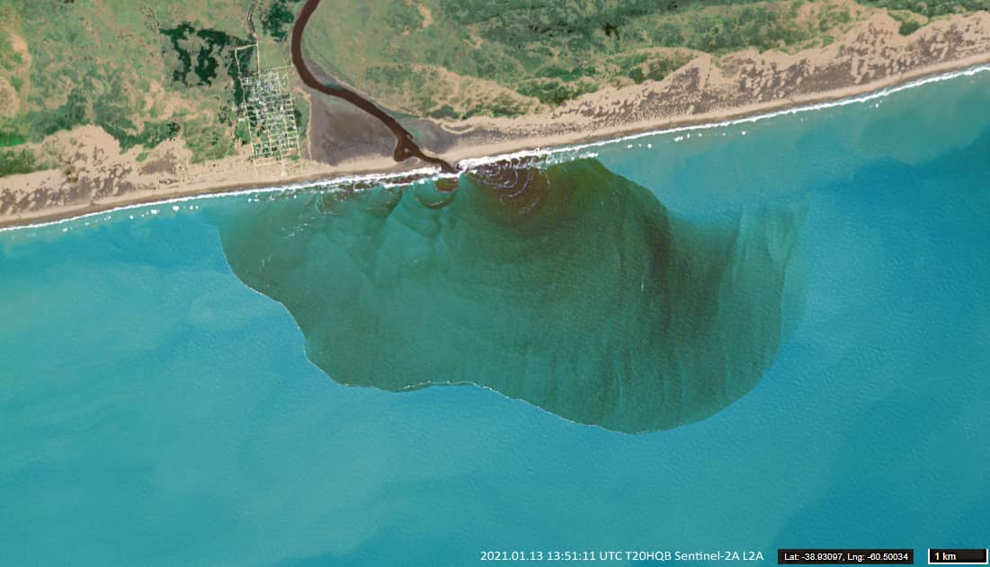
During the entire period of Sentinel-2 observations (since 2018), a similar event has only been observed once at Río Quequén Salado, in January 2021, and even then only on a smaller scale (Figure 2). Usually, the sediment plume (if present) does not exceed a few hundreds of meters.
The most interesting feature here is the (not often observed) presence of waves propagating from the river mouth along the sediment plume towards the shore, marked by white foam. It can be assumed that this is the result of the interaction between the river outflow and the waves of the sea surf.