Underwater forests around Kerguelen
Kerguelen Islands | Southern Indian Ocean
• 2026.01.25 | 05:02:31 UTC
• 2026.02.02 | 05:12:19 UTC
Sensor: Sentinel-2B, C L2A
The Kerguelen Archipelago lies on the Kerguelen Plateau in the southern Indian Ocean, rising around 3,700 metres above the surrounding deep-sea floor. Formed some 40 million years ago by sustained volcanic activity, it is one of the oldest surviving oceanic archipelagos. Today, there is no permanent civilian population; human presence is limited to a research station at Port-aux-Français.
Along its coasts, extensive kelp beds dominate the shallow waters. These are mainly formed by Macrocystis Pyrifera, a giant macroalga common in temperate and sub-Antarctic regions. Growing up to 50 metres in length (see images from Patagon Journal and Science Photo) it forms dense underwater forests that provide habitat for a wide range of marine species and contribute to long-term carbon storage.
The depth distribution of these kelp forests is largely controlled by light availability and therefore by water clarity. Under typical conditions, they extend down to 1–12 metres, but can reach greater depths where the water is clearer.
The region is shaped by strong westerly winds. The mountainous western part of the islands often blocks cloud cover, leaving the northeastern areas more frequently cloud-free — a clear advantage for satellite observations.
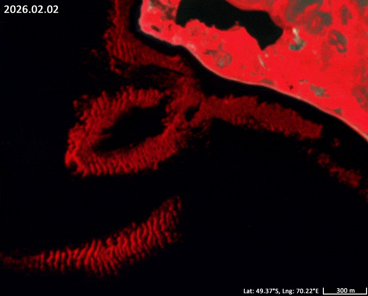
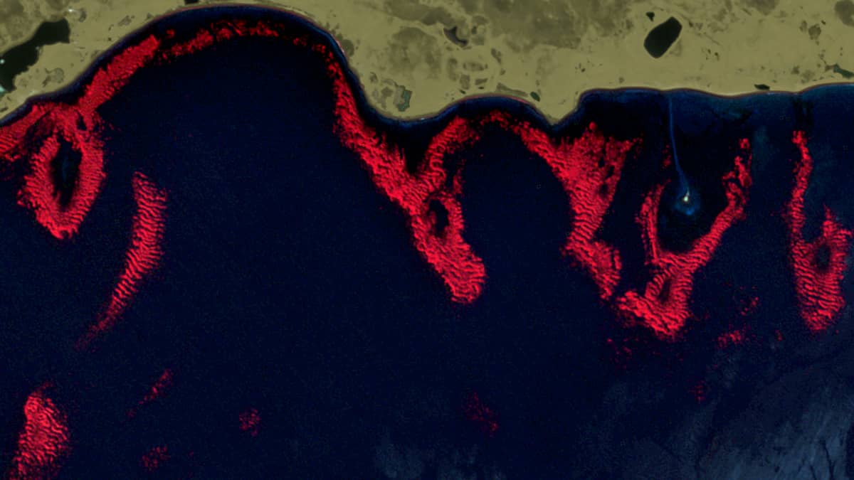
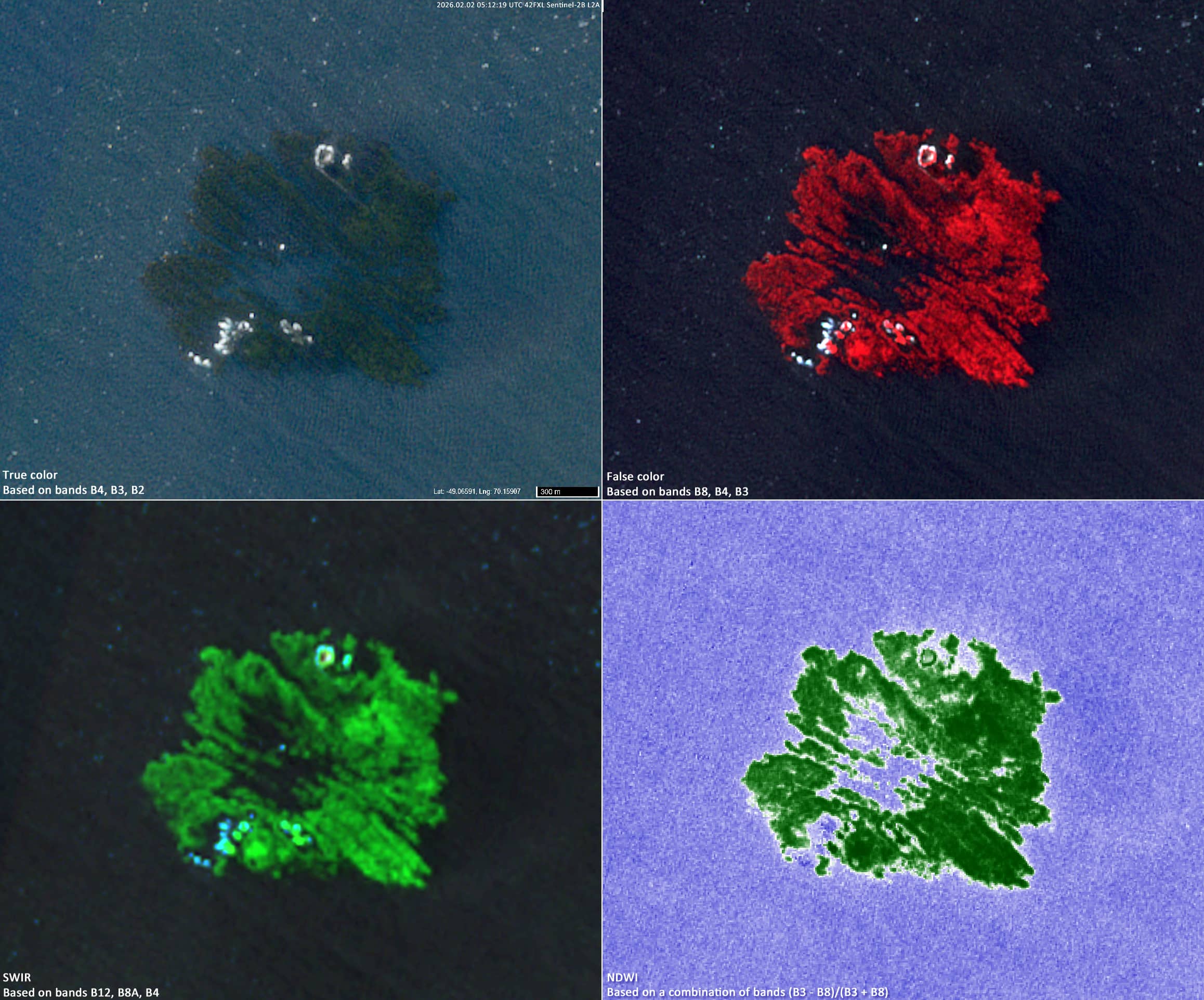
In satellite imagery, kelp beds appear as dark patches along the coastline (Figures 3 top, 5).
When using near-infrared false-colour composites (R→B08, G→B04, B→B03), they stand out clearly in red tones, while open water appears dark due to strong absorption in the NIR range.
Sentinel-2 data reveal fragmented kelp forests around the Courbet Peninsula (Figures 1 to 3). show fragments of subtidal kelp forests detected in Sentinel-2 imagery, primarily through the use of the B8, B4 and B3 RGB composition.
By combining multiple cloud-free scenes from the southern summer, their overall distribution becomes visible (Figure 4). A comparison of images from 2017 to 2026 suggests a decline in kelp extent northwest of the Prince de Galles Peninsula (see Figure 5 and Animation 1).
One particularly striking feature is an isolated reef in Baie Accessible (49.066°S, 70.16°E, see Figure 5). WIn NIR imagery, its shape resembles a carnation flower. A small rock outcrop is visible at the surface, while below it a steep underwater structure rises from the seafloor — likely the remnant of a former volcanic summit. This elevated feature hosts a kelp forest of roughly 2 km².
Further reading
Presqu’île du Prince de Galles (Wikipedia, French)
Kerguelen Kelp Beds, Southern Indian Ocean (NASA Science)
Macrocystis (Wikipedia)
Fig. 1
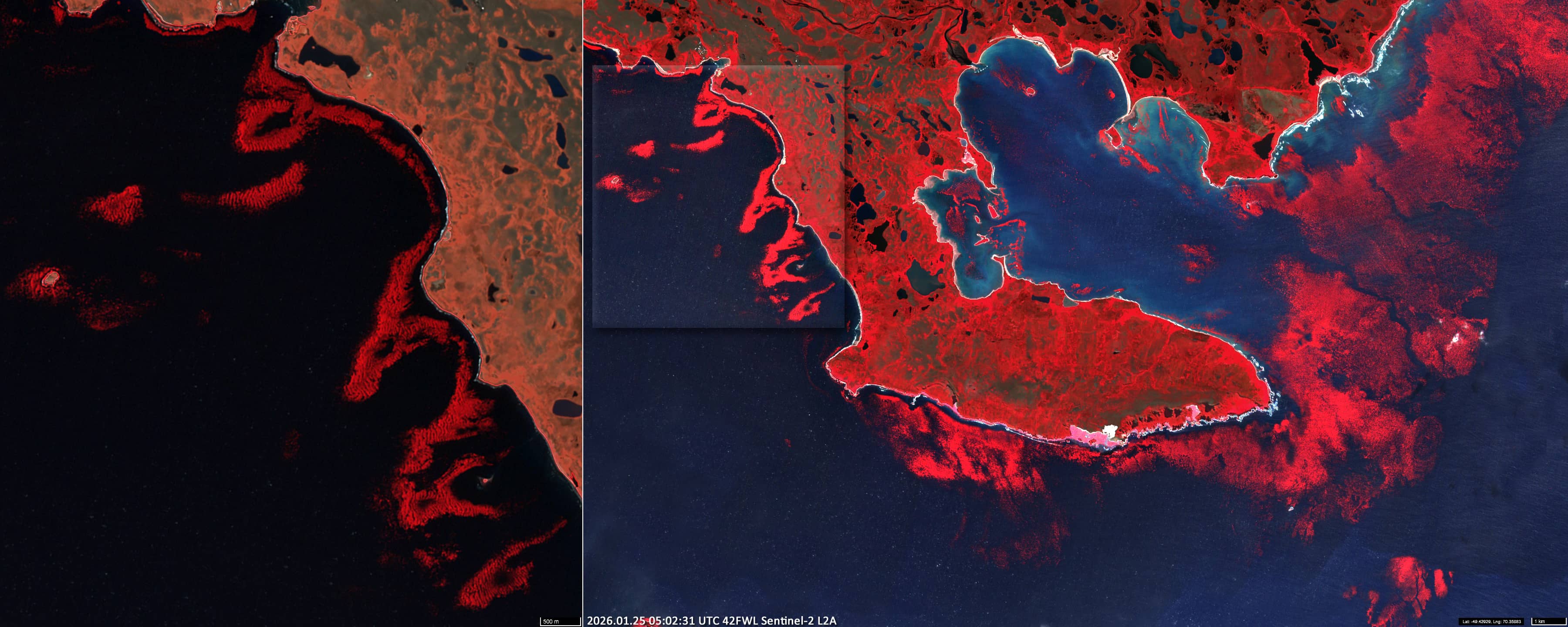
Fig. 2
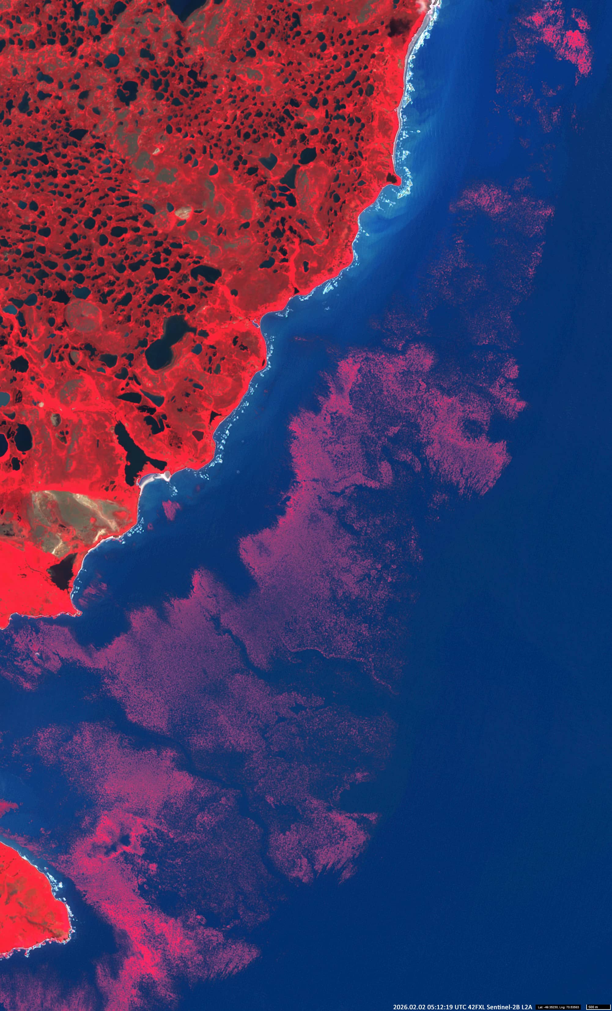
Fig. 3
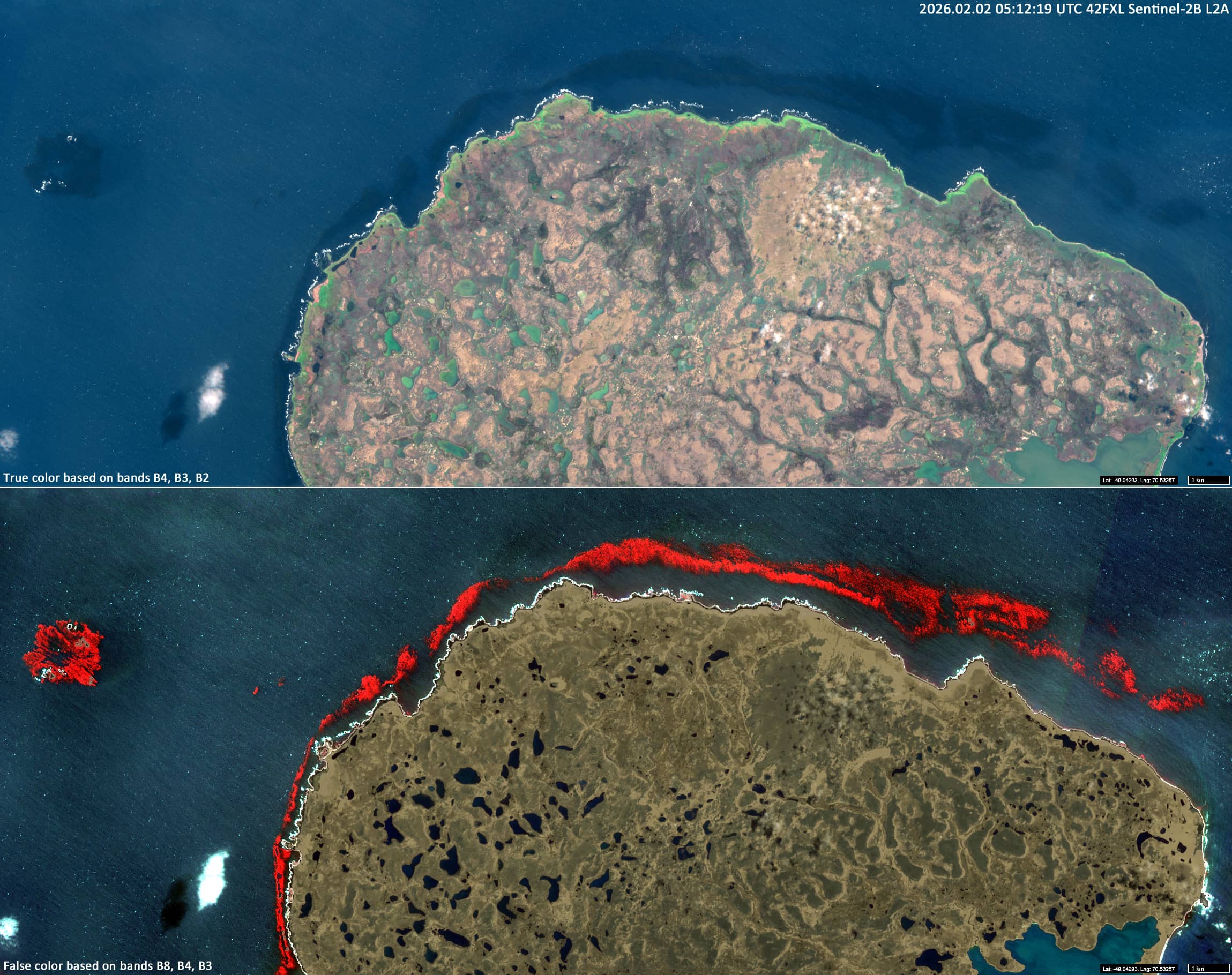
Fig. 4
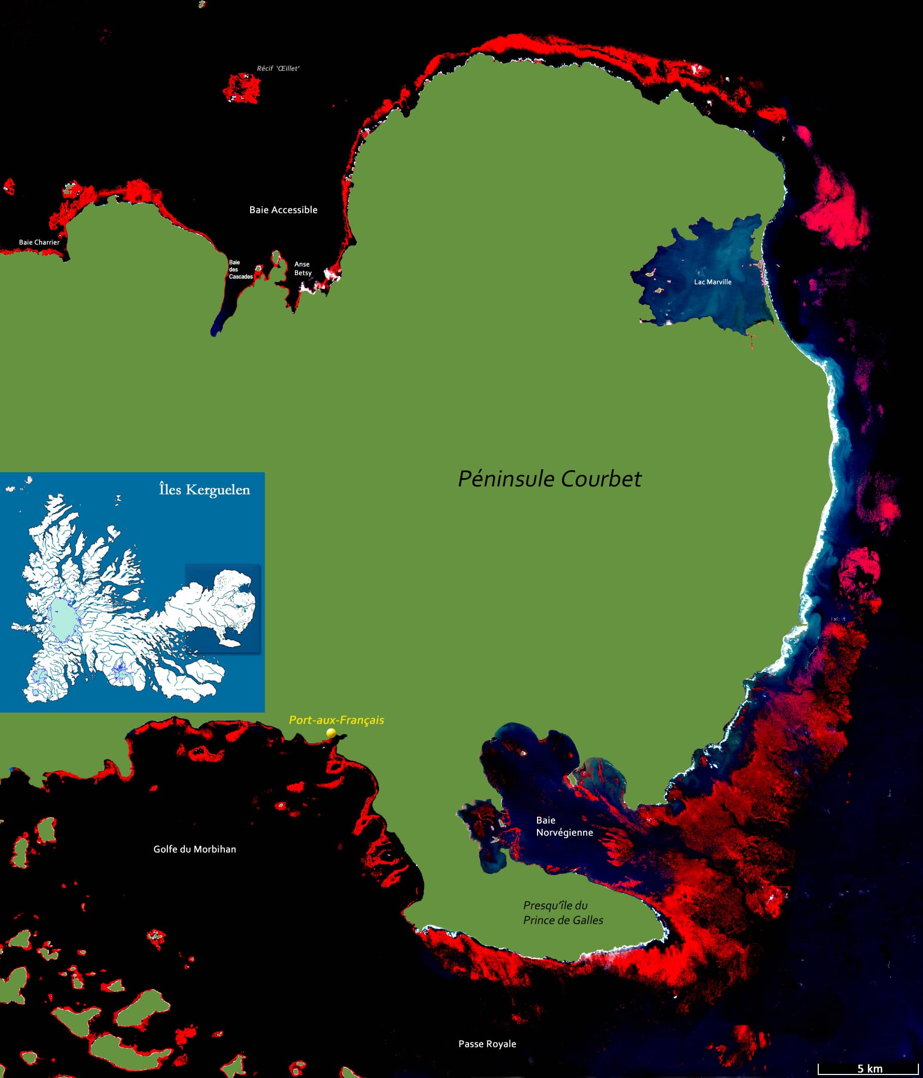
Fig. 5
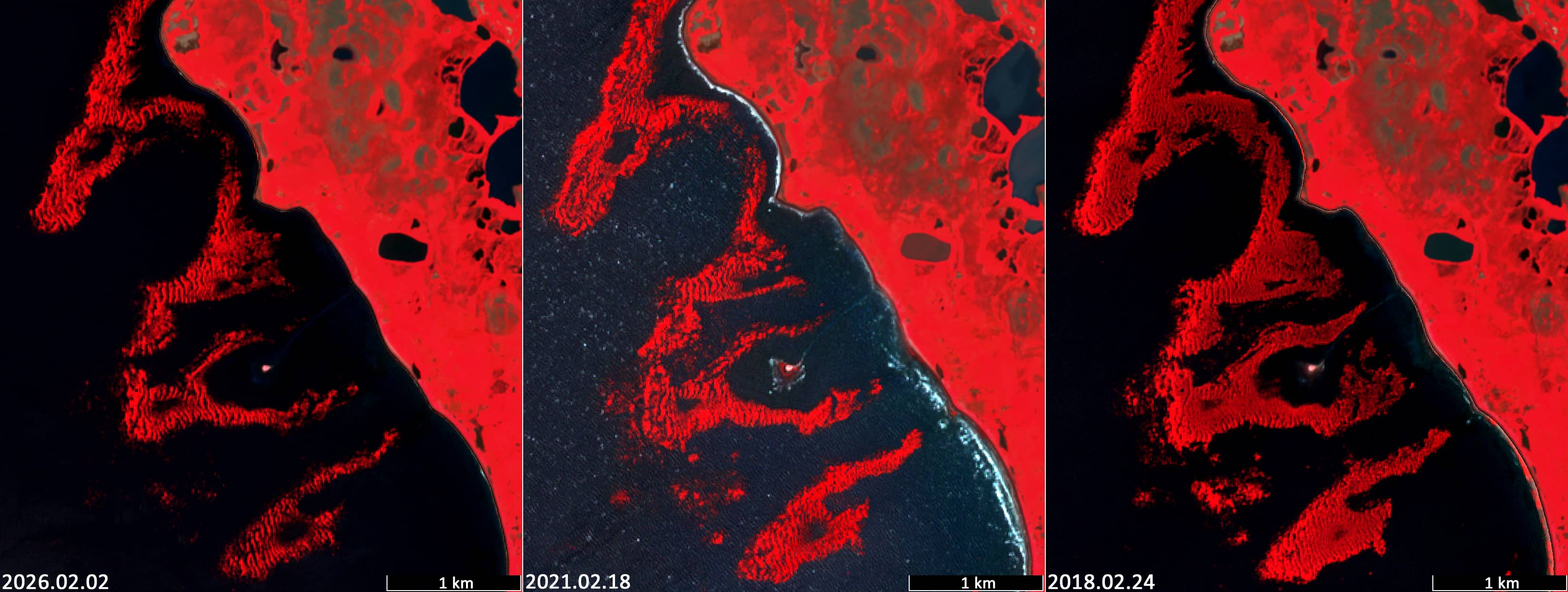
Fig. 6
Animation 1