
Dust storms from North Africa
North Africa, Mediterranean Sea
Dates of acquisition:
• 2026.02.15 08:35:20 UTC (Sentinel-3A OLCI)
• 2026.02.15 – 2026.02.19
Sensors: Meteosat Third Generation (MTG) 0° longitude, Sentinel-3A OLCI, Sentinel-2C L1C
Coordinates:
• 32°N, 33°E;
• 34°N, 22°E;
• 17°N, 24°W
In mid-February, intense sand and dust storms originating in North Africa were observed, , leading to the formation of extensive aerosol clouds over the Mediterranean Sea and the central-eastern Atlantic Ocean.
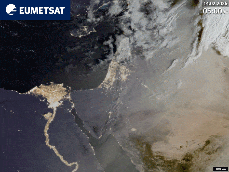
On 14 February, a pronounced dust cloud was detected over the easternmost Mediterranean region, spreading eastwards. This event occurred alongside strong winds that developed along the pressure gradient between a cyclone over the Tyrrhenian Sea (with a minimum air pressure at sea level of 985 hPa) and an anticyclone over Egypt (with a maximum air pressure at sea level of 1018 hPa).
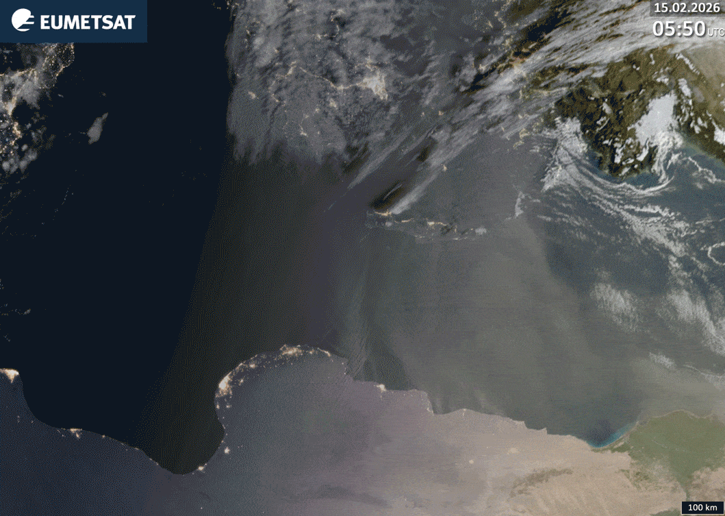
By 15 February, the cyclone had moved eastwards towards the Adriatic Sea, while the high-pressure area had intensified and expanded north-eastwards, extending over the eastern Mediterranean and Asia Minor. The increased pressure gradient between these systems generated strong surface winds, producing a significant dust cloud from eastern Libya that moved northwards toward Greece.
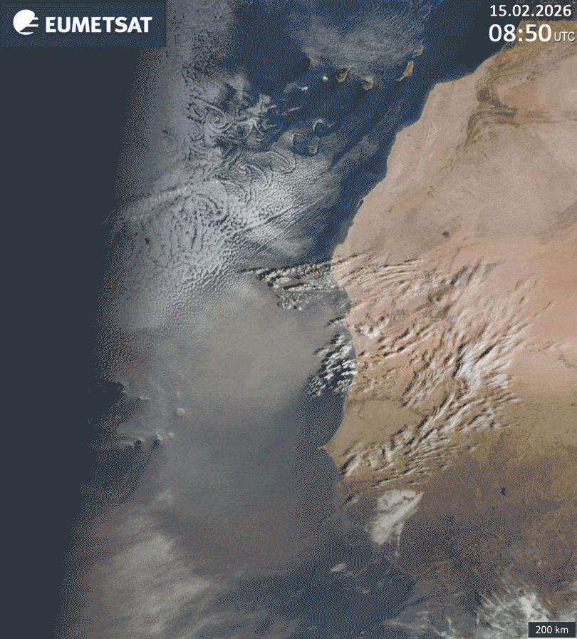
On the same day, 15 February, a strong westward-moving dust outflow developed in West Africa, stretching from Mauritania to Guinea. This was driven by winds along the periphery of a large high-pressure system centred between the Azores and the Canary Islands (maximum pressure of 1036 hPa).
On 16 February, the dust storm spread northwards to Western Sahara and Morocco, and westwards to around 28°W longitude. It then continued to move westwards, reaching 61°W longitude (eastern Venezuela) on 22 February.
Four animations are provided to illustrate the above-described phenomena. These are based on images labelled “GeoColour RGB – MTG – 0 degrees” from the EUMETView website and use data from the European Meteosat Third Generation (MTG) satellite. This is a joint mission between the European Space Agency (ESA) and the European Organisation for the Exploitation of Meteorological Satellites (EUMETSAT), which aims to ensure the continuity of operational meteorological observations.
Animation 1 shows the development of the dust cloud over the eastern Mediterranean during the daytime hours of 14 February, with a temporal resolution of 10 minutes.
Animation 2 depicts the expansion of the dust cloud over the central Mediterranean during the day on 15 February, also at 10-minute intervals.
Animation 3 shows the movement of the dust cloud over the eastern Atlantic during the day on 15 February, also at 10-minute intervals.
Animation 4 shows the development of the dust cloud over the eastern Atlantic from 15 to 19 February, with a temporal resolution of 30 minutes.
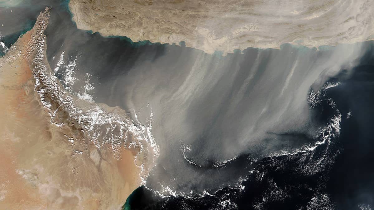
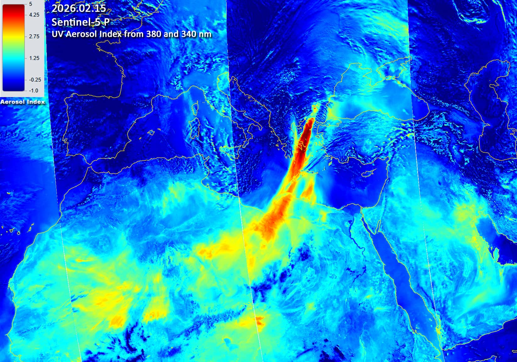
Additionally, Figure 5 shows a Sentinel-3 satellite image () of the dust cloud over the central Mediterranean on 15 February, while Figure 6 illustrates the aerosol index over the Mediterranean, as measured by Sentinel-5 on the same day.
Further reading
Geography of Syria (Wikipedia)
Jabal al-Druze (Wikipedia)
Extreme Saharan dust events expand northward over the Atlantic and Europe, prompting record-breaking PM₁₀ and PM₂.₅ episodes (Atmospheric Chemistry and Physics)
Animation 1
Animation 2
Animation 3
Animation 4
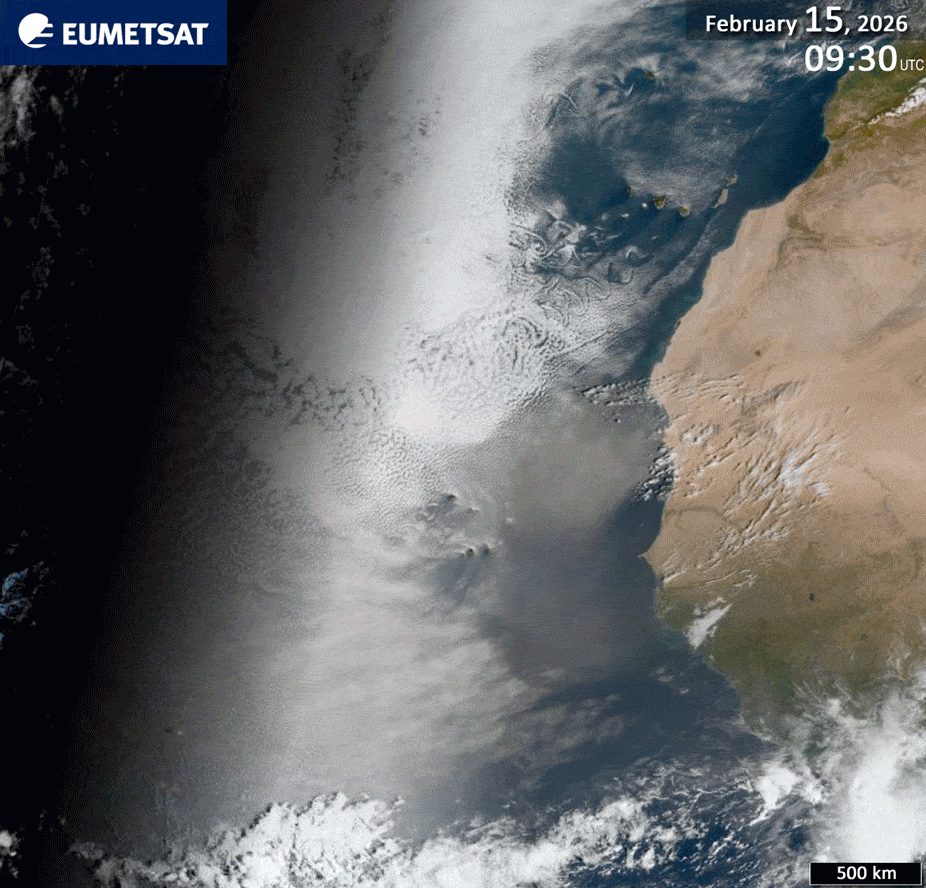
Fig. 5
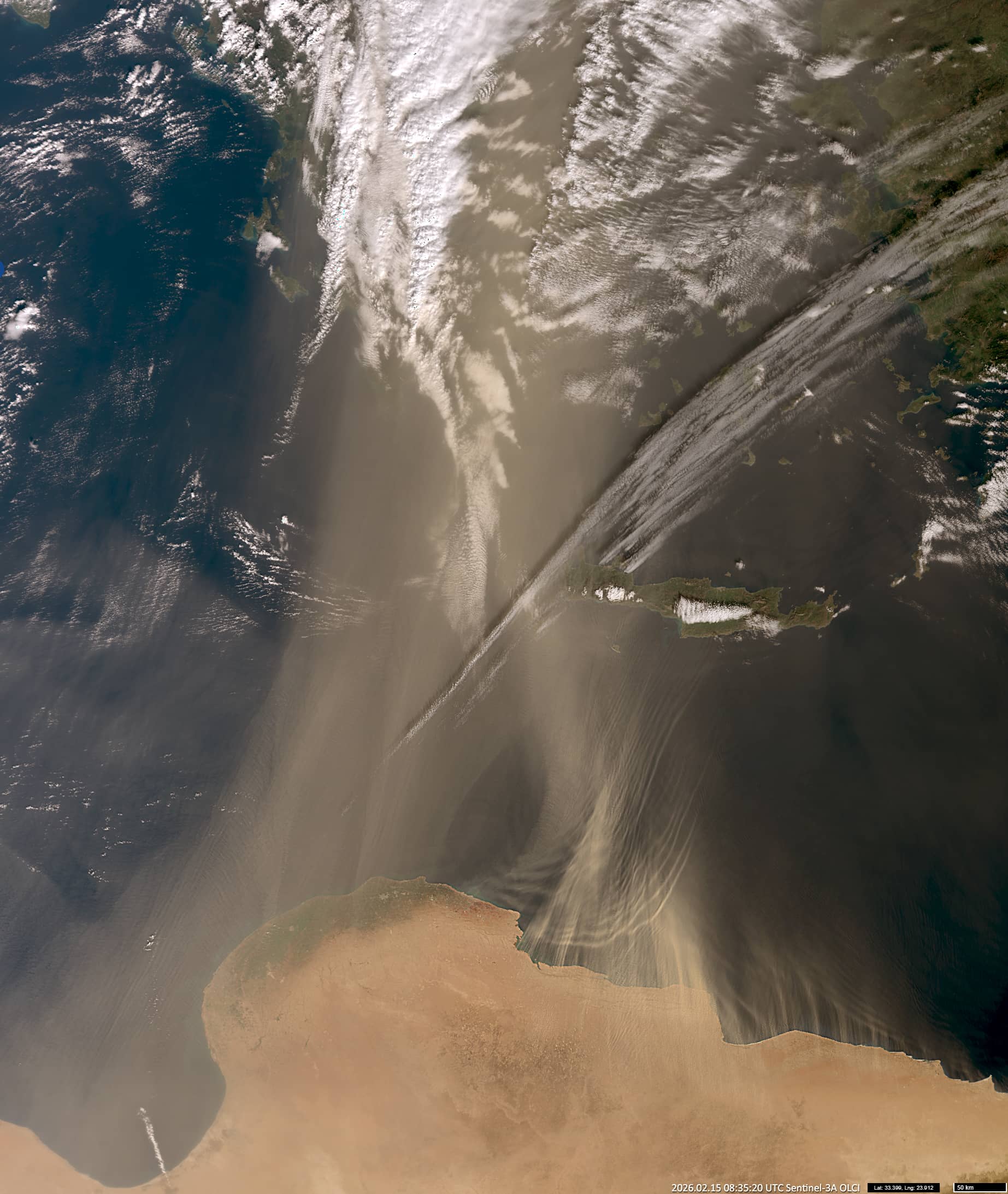
Fig. 6
Contains modified EUMETSAT Meteosat data [2026]