Sea Surf near East Frisian Islands
Lower Saxony mainland coast | German North Sea coast
Date of acquisition: November 17th, 2025 | 10:43:41 UTC
Sensor: Sentinel-2C L1C
Coordinates: ca. 53.7°N, 7.4°E
The seven East Frisian Islands (German: Ostfriesische Inseln) are a chain of islands located in the North Sea, off the coast of East Frisia in the German State of Lower Saxony. Together with the surrounding sea, they form part of the Lower Saxony Wadden Sea National Park.
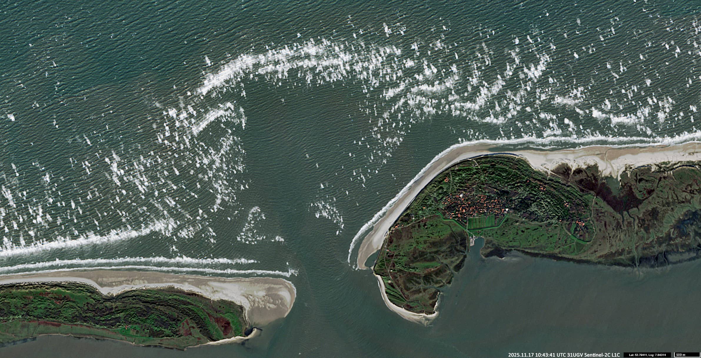
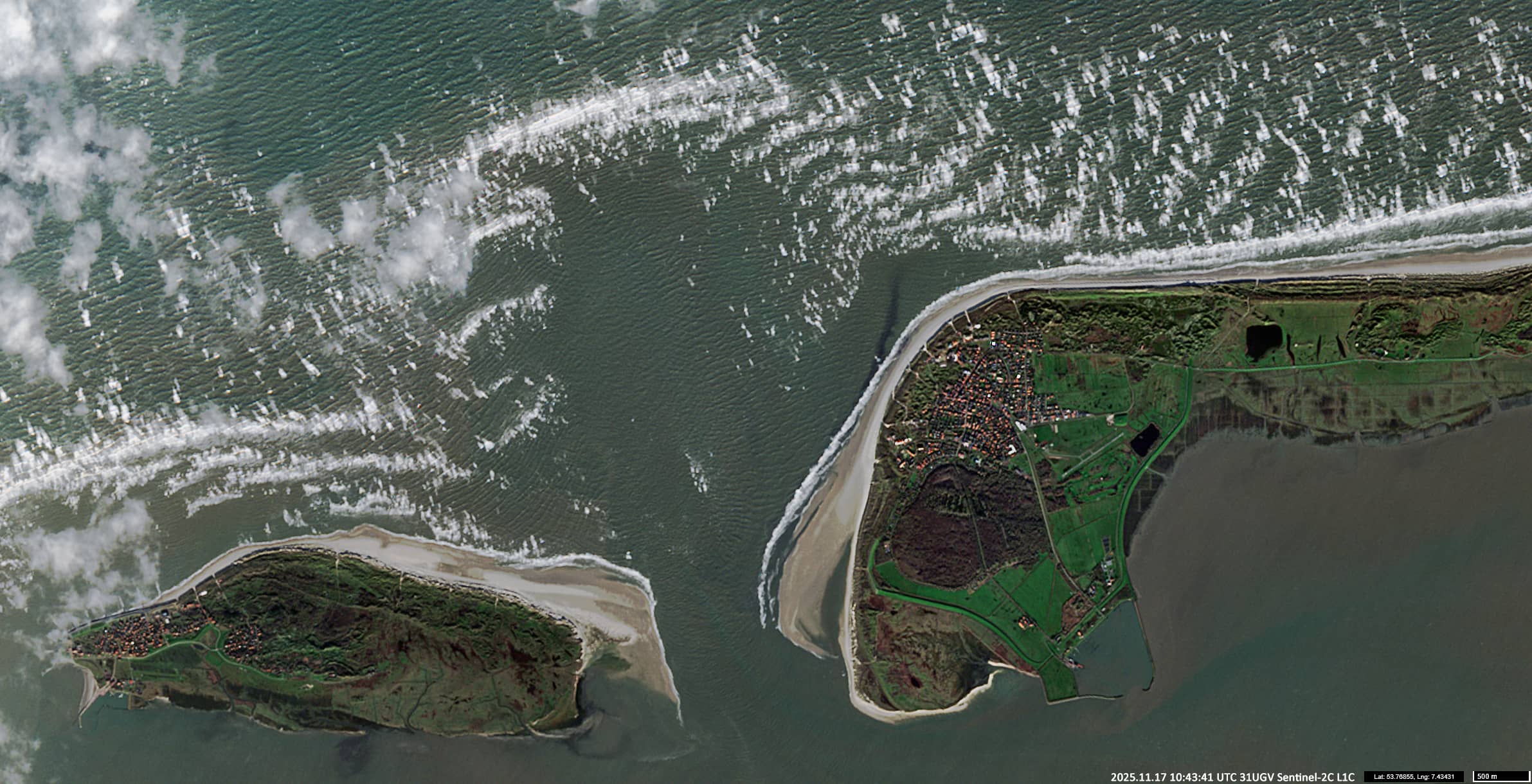
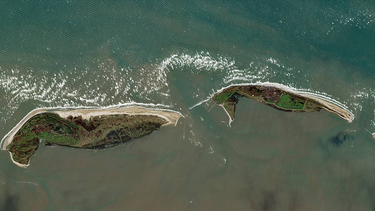
The presented Sentinel-2 image spectacularly captures the curved surf strips facing the sea and the associated foam fields (see Figures 1 and Figures 2, 3 for details).
The closer to the shore, the shallower the sea and the steeper the waves become. This causes more foam to be blown away from the wave crests by the wind, known as white foam. The tiny water droplets in the foam reflect light of all colours from their surfaces, making them appear white to a distant observer.
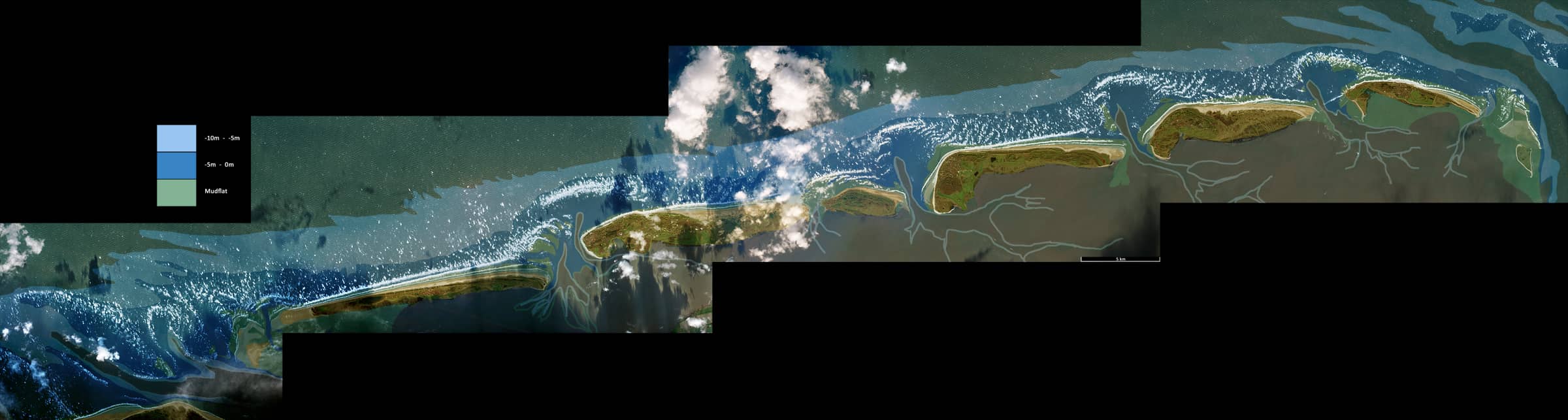
The location of the foam fields is influenced by the topography of the seabed. This can clearly be seen in Figure 4. The foam forms above the edge of a 5-metre-deep isoline, where there is a sand and sediment deposit (ebb-tidal delta shoals), especially opposite the passages between the islands (Seegatts). In this specific acquisition, a north wind with speeds of up to 40 km/h meets the ebb tide from the south (the ebb tide began an hour and a half before this image was taken), resulting in a rather sharp foam front and a spectacular picture.
Further reading
East Frisian Islands (Wikipedia)
Gezeiten auf Norderney (Norderney Unterkunft, German)
Wind speed (Zoom Earth)