Somewhere in the Canadian wilderness
Western Nunavut Territory | Canada
Dates of acquisition:
- October 6th, 2025 | 20:03:31 UTC
- July 28th, 2025 | 19:59:21 UTC
Sensor: Sentinel-2C L2A
Coordinates: ca. 68.5°N, 119.4°W
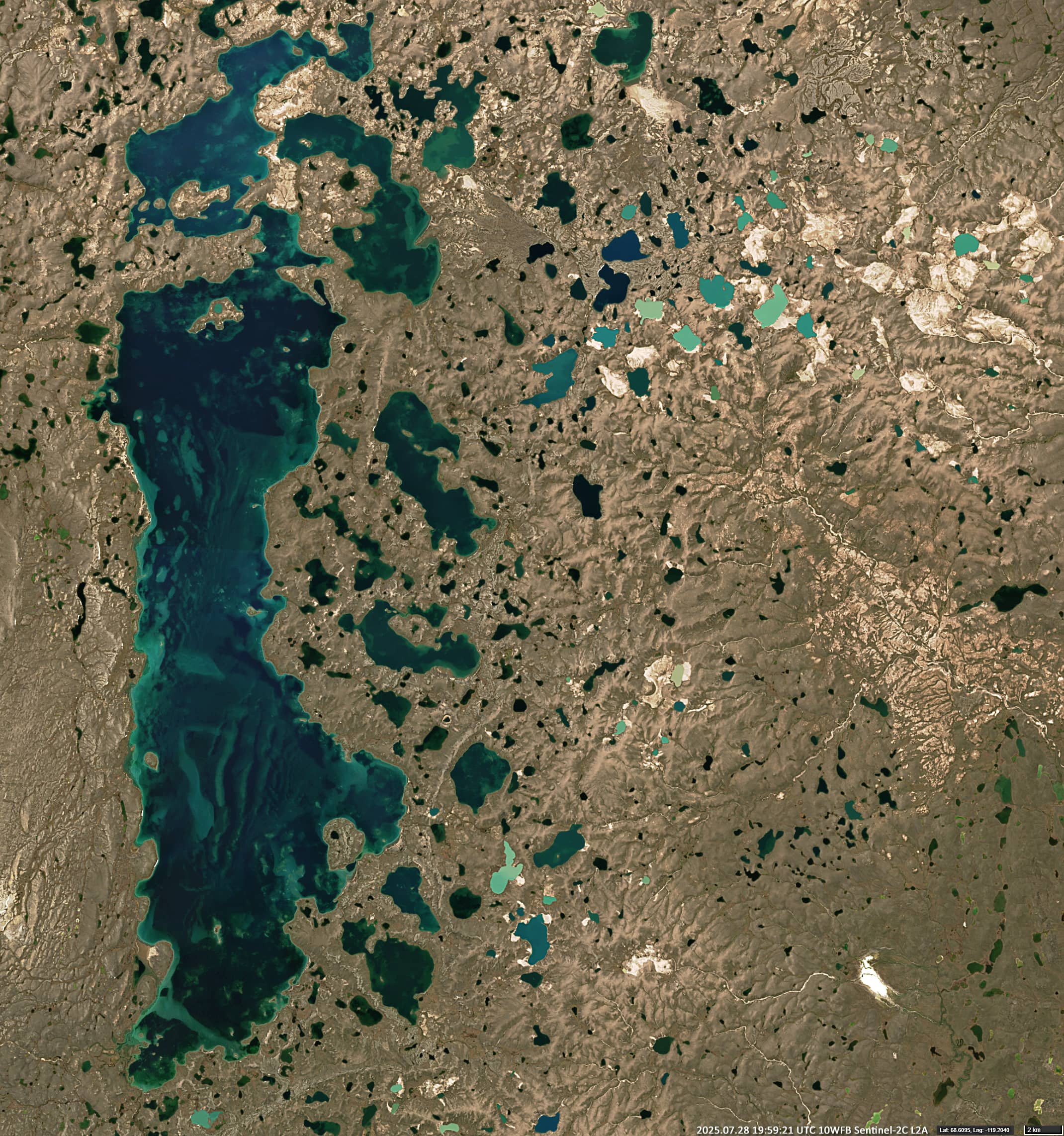
Bluenose Lake, which covers an area of around 430 km², is located in a tundra landscape within a vast basin among the Melville Hills, in the Kitikmeot Region on the western edge of the Canadian territory of Nunavut (see Figure 1). Although it is by no means small, with a surface area about 75% that of Lake Geneva, the lake was previously unnamed and did not receive its official name until 1953. It is probably named after the Bluenose caribou.
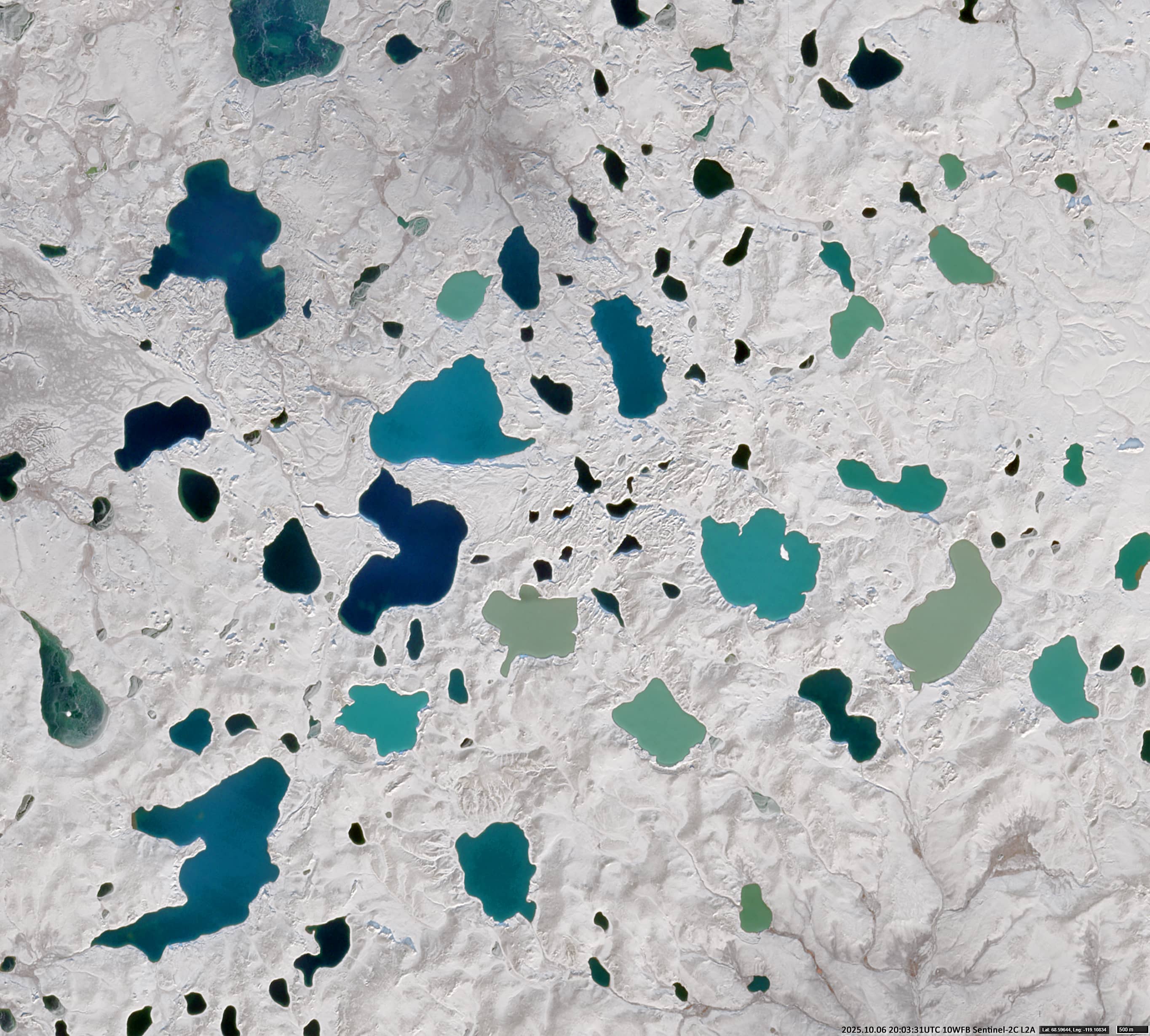
About 20 kilometres east of the northern part of Bluenose Lake, in a hilly area, lies a group of small lakes connected by narrow channels. Hardly anyone has ever set foot there, and perhaps no human has ever been to some places. The area is extremely difficult to reach and can only be accessed by boat in summer. In winter it is bitterly cold and there’s really nothing to do there.
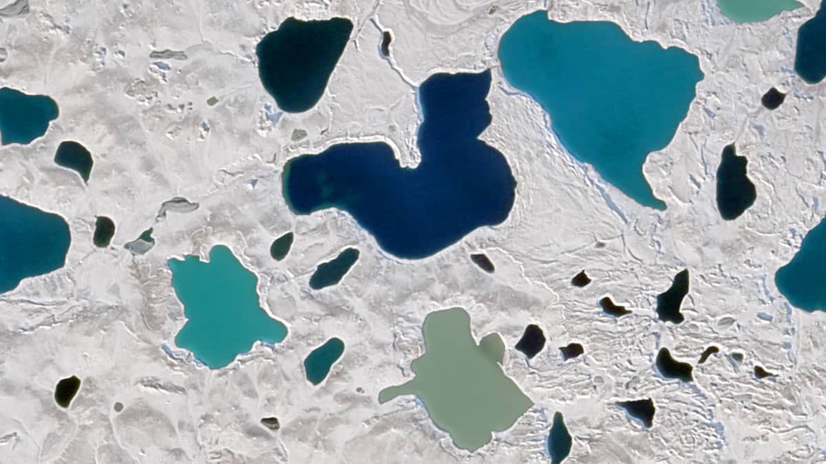
How many people have seen these lakes with their own eyes? All of them? All of these small lakes, each covering an area of no more than three square kilometres, and each one a different water colour?
How many people even know their names? Do they even have names?
In mid-autumn, when the ground is already dusted with snow but the lakes are not yet frozen, they appear on satellite images as vibrant patches of sage green, cyan, turquoise, green, and deep blue due to their mineral content and glacial sediments (Figure 2).
Even in summer, the lakes retain the same colours year after year.
Climate scientists and ecologists use the area as a benchmark for pristine Arctic ecosystems.
Further reading
Bluenose Lake (Wikipedia)
Canadian Geographical Names Database (CGNDB)