Beauty generator
San Matías Gulf | Eastern Patagonia (Argentina)
Dates of acquisition:
• 2025.06.14 | 13:57:21 UTC
• 2025.05.30 | 13:57:09 UTC
• 2024.08.23 | 13:56:59 UTC
etc.
Sensors: Sentinel-2A, B, C L2A
Coordinates: ca. 42.24°S, 64.42°W
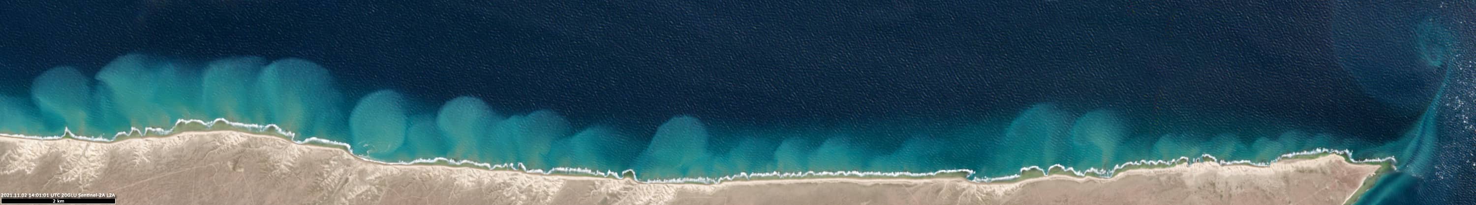
The San Matías Gulf lies on the Atlantic coast of Argentine Patagonia. San José Gulf is the southern part of San Matías Gulf, cutting into the base of the Valdés Peninsula. To the south, the peninsula is bordered by Golfo Nuevo, separated from San José Gulf by the narrow Carlos Ameghino Isthmus. Because the tides in San José Gulf and Golfo Nuevo are offset by several hours, water levels on either side of the isthmus fluctuate almost alternately, creating strong tidal currents.
The Valdés Peninsula is also a refuge for southern right whales and seabird colonies, earning it UNESCO World Heritage status since 1999.
Strong tidal currents and winds transport different water masses with sediments and algae between the gulfs, creating spectacular eddies and turbulence.
All of this can clearly be seen in the high-resolution satellite images from Sentinel-2 (see Figure 2, for example).
It is worth noting that the most spectacular cases were observed in late summer to early spring (in the Southern Hemisphere).
The various forms are presented in the attached images.
Snail-shaped eddies (Figure 3):
These structures form during the incoming tide in San José Gulf. Sediments from the coastal waters around Punta Buenos Aires are “sucked” into the gulf and slowed down by the calmer waters further south, near the Carlos Ameghino Isthmus. The eddies then turn eastward into an area with lower current speeds.
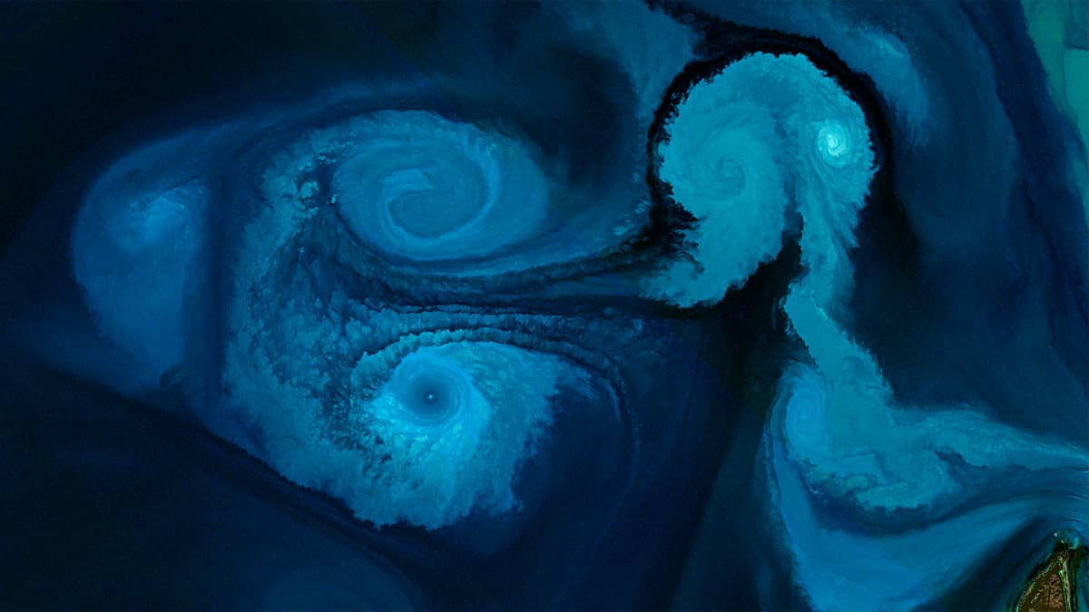
Galaxy-shaped eddies (Figure 4):
These structures form in San Matías Gulf, near San José, during low tide. They rotate cyclonically in accordance with the Southern Hemisphere. The high concentration of dissolved material in the vortexcenters enhances the visual impression, resembling images of galaxies in space. The white wave crests resemble individual stars and contribute to this impression.
Double eddies (and single ones – see above) (Figure 5):
During low tide, water flows rapidly out of the narrow strait between San José and San Matías, while the surrounding waters remain comparatively calm. This contrast in speed causes the current to curl at its edges, producing two large rotating eddies. Because rotating water tends to conserve its momentum, these eddies can remain stable for quite some time and may reach up to 12 km in size.
The flow is not limited to the surface: it extends into deeper layers of the water column, giving the eddies a three-dimensional character. Over successive tidal cycles, these double eddies can meet, merge, or break apart, creating a constantly evolving pattern of vortices in the gulf.
Monster-like structures (Figure 6):
A similar explanation applies to the monster-like structures that appear during high tide in the San José Gulf . Since the San José Gulf is much smaller, shallower, and calmer than the San Matías Gulf, the double eddies spread further (up to a size of ~25 km) and interact with new tidal waves that arrive every 5–6 hours, as previously mentioned.
Streets of White Wave Crests (Figure 7):
These very interesting and rarely observed structures are formed by sea foam on wave crests.
Their formation could be explained by powerful tidal currents between the bays of San Jose and San Matías with the accompanying parallel jet streams in the water. These interact with strong southwest winds (40-60 km/h) and the accompanying wind-driven ocean waves. Foam can form on their surface, which is then blown away by the wind.
Other:
Other interesting structures are also frequently seen – for example, in Figure 8.
General images of the region:
See Figure 1.
Further reading
San Matías Gulf (Wikipedia, Spanish)
San José Gulf (Wikipedia, Spanish)
Fig. 1
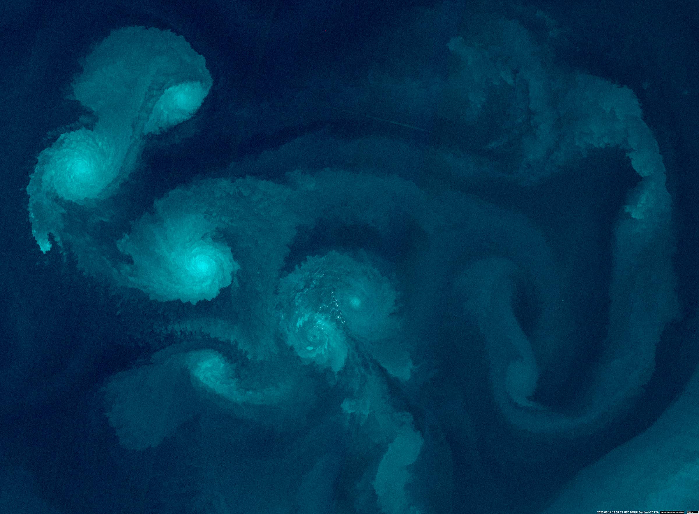
Fig. 2
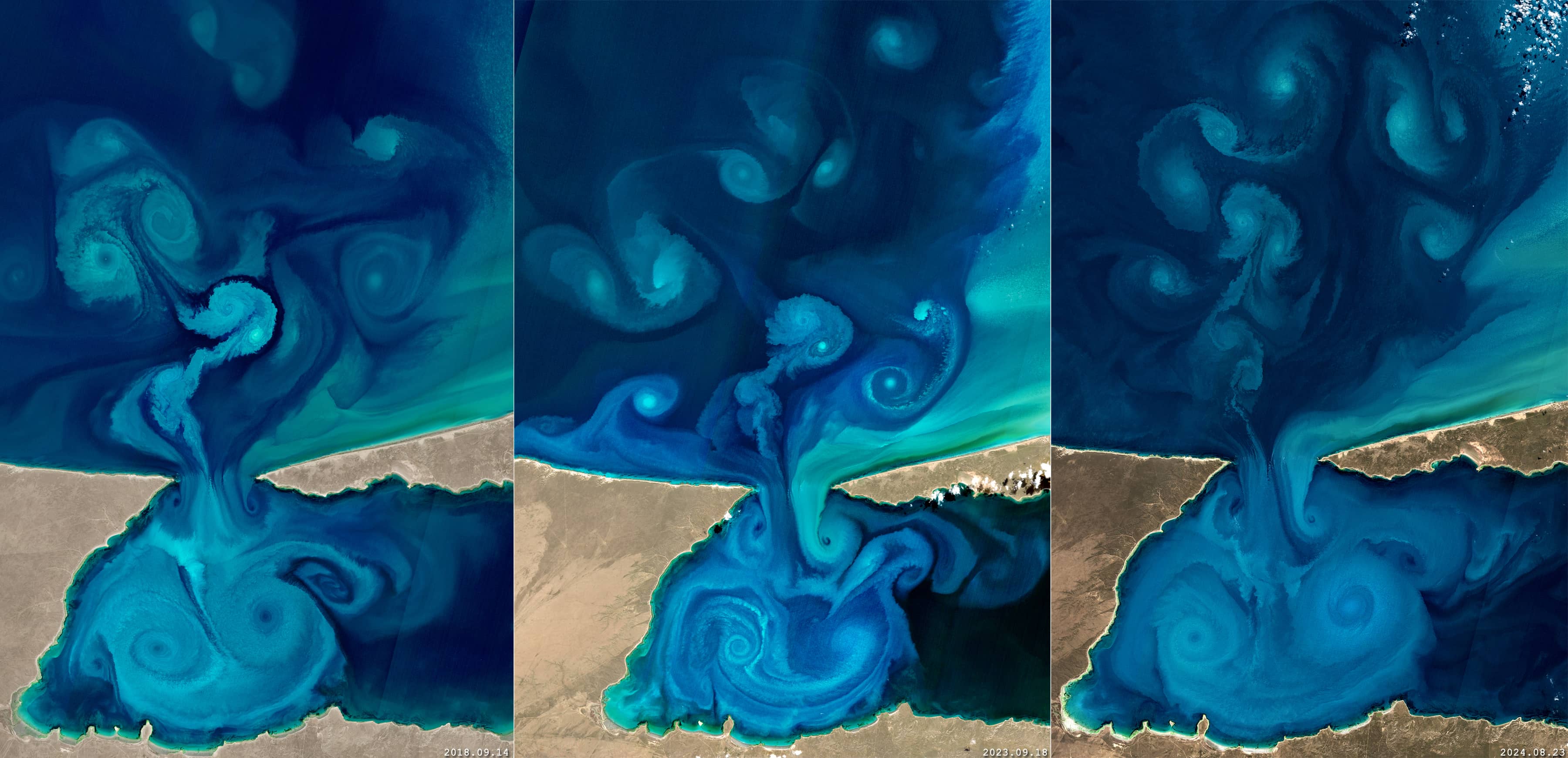
Fig. 3
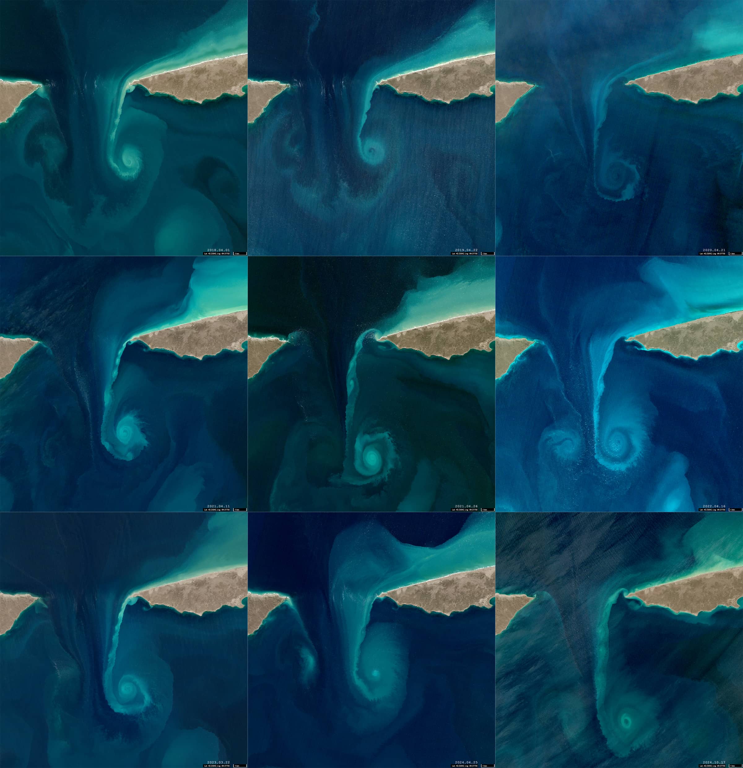
Fig. 4
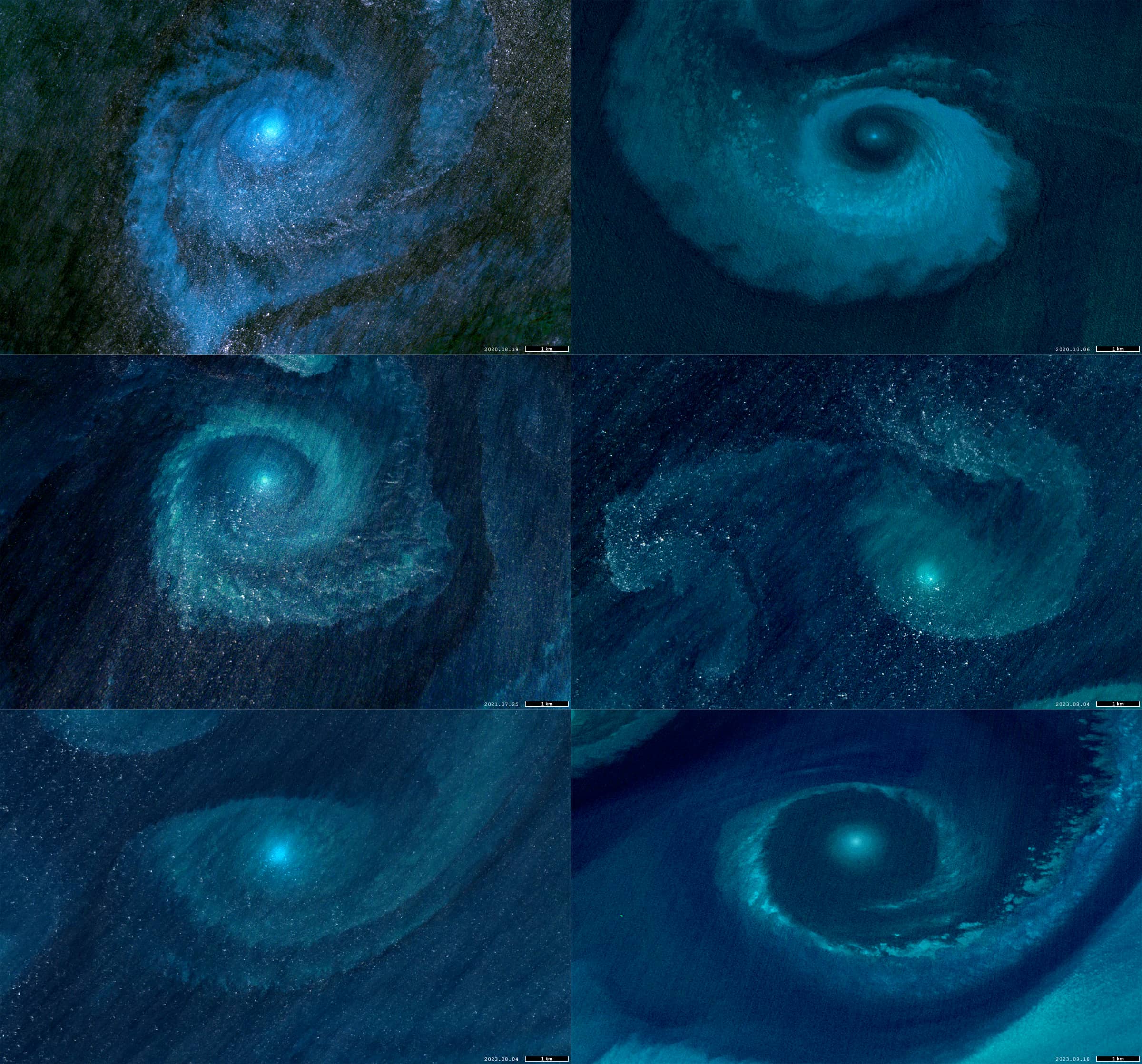
Fig. 5
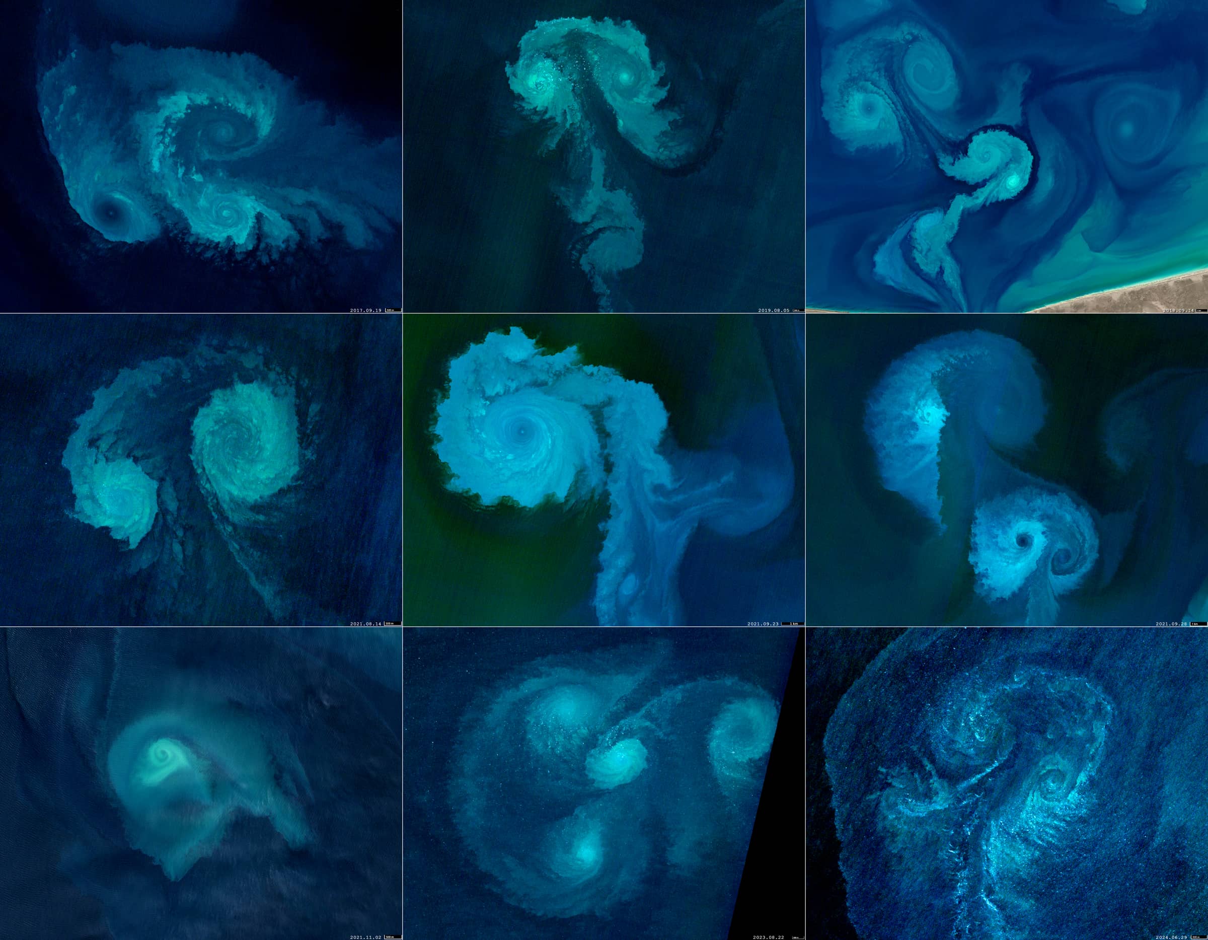
Fig. 6
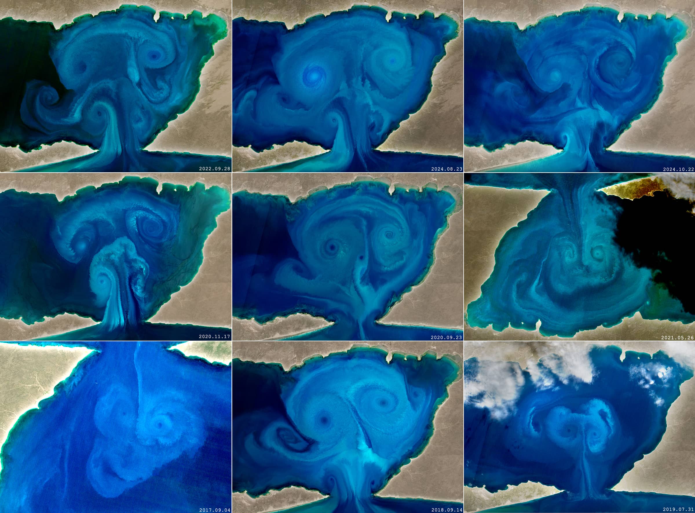
Fig. 7
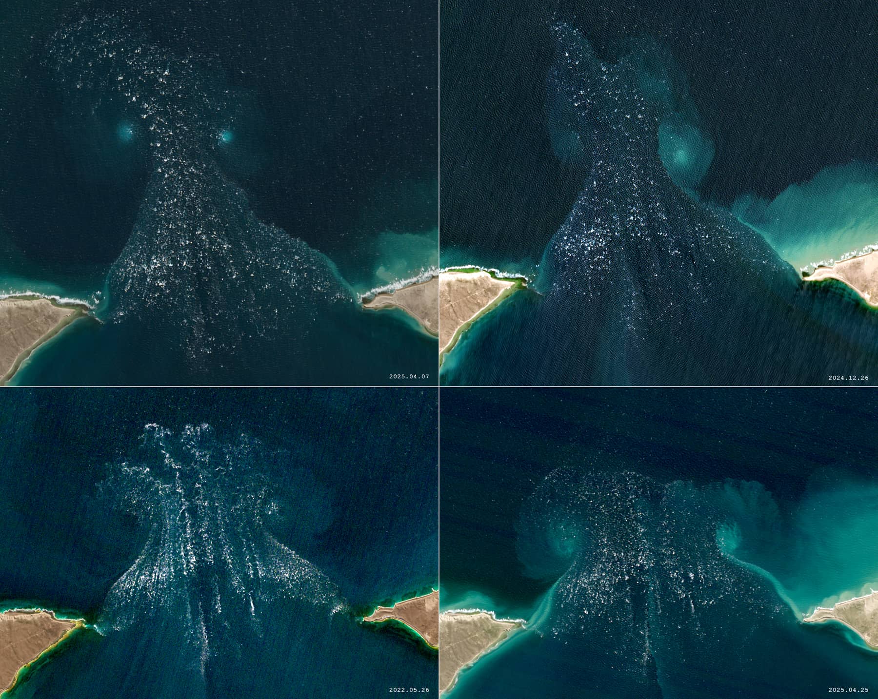
Fig. 8