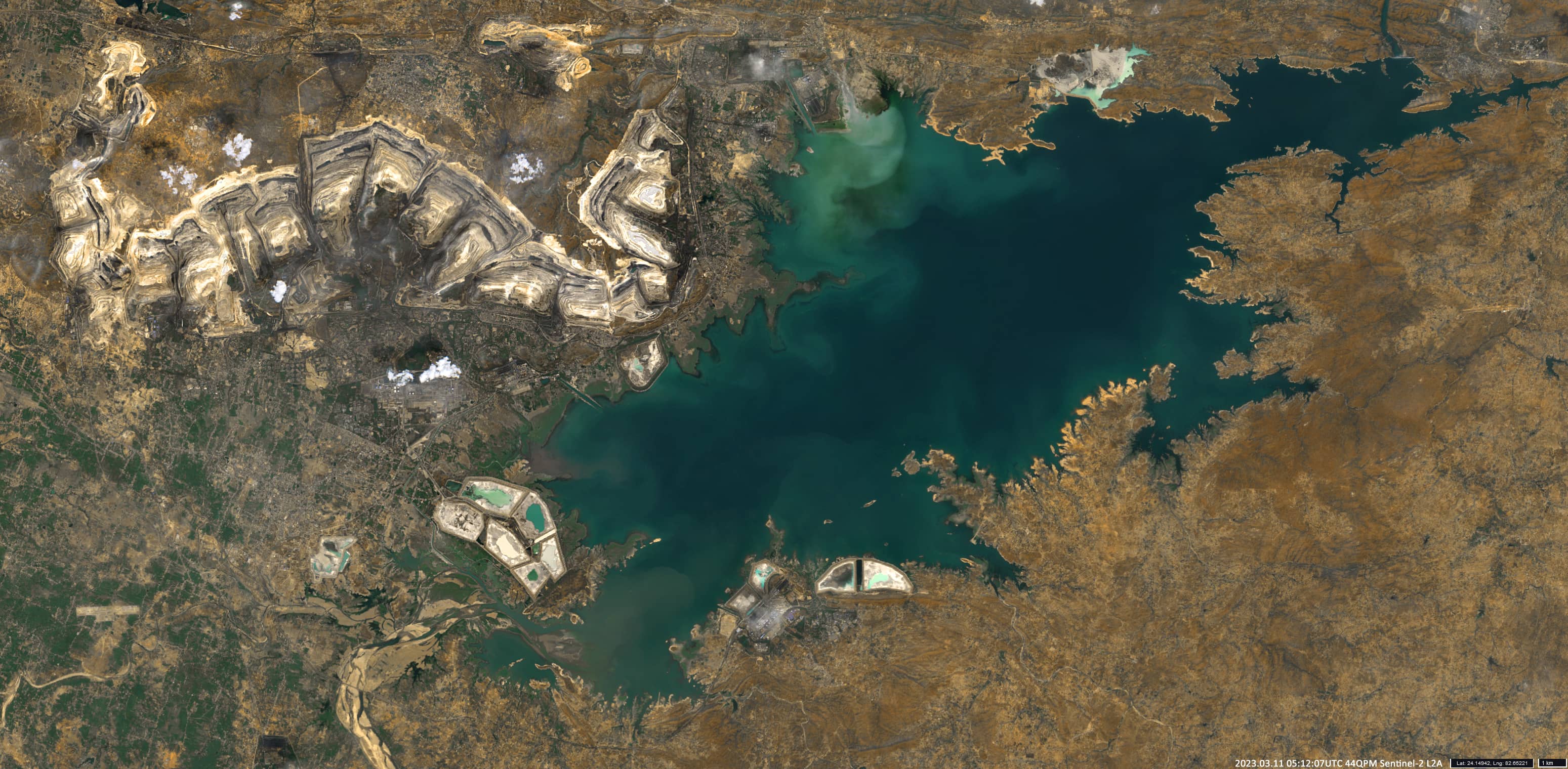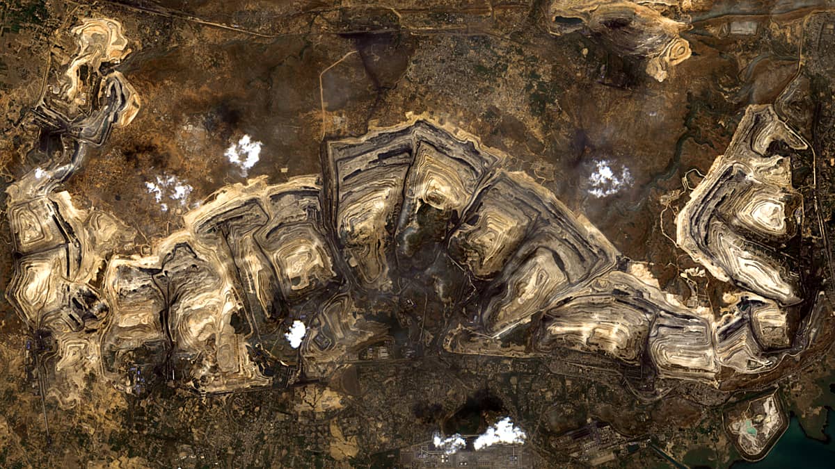
Singrauli Coalfield
Madhya & Uttar Pradesh | Northeast India
Date of acquisition: March 11th, 2023 | 05:12:07 UTC
Sensor: Sentinel-2A L2A
Coordinates: ca. 24.2°N, 82.7°E
India has the fifth largest coal reserves in the world. India’s rapid development requires the country to triple its coal production and it became the world’s second largest CO2 emitter. The Singrauli Coal Mines (pictured) is a 70 million tons per year mining network located in the Singrauli coalfield in the Indian states of Madhya Pradesh and Uttar Pradesh. It covers an area of nearly 2200 km2. In Singrauli numerous coal-fired thermal power plants are located and some of them are very close to the mines. If all existing and proposed projects are implemented as planned, the region will have a total of 30 GWh of coal-fired power generation capacity, which is equivalent to 10-15% of the country’s total electricity generation. For comparison, peak electricity demand for the whole of the UK is 57 GWh, and for Germany about 74 GWh. While Singrauli is one of India’s largest energy hubs, it is geographically isolated. Besides the mines and power plants, some towns have been constructed, villages and company colonies with their own schools, sports grounds and clinics. To get to this area, one has to travel 220 km from the nearest airport and the journey can take eight hours.
In the presented Sentinel-2 image, the entire region and the nearby Rihand Dam, also known as Govind Ballabh Pant Sagar, India’s largest man-made lake by volume, can be seen. It is located on the Rihand River.