"Convective Cells"
"Coast Vortex" Phenomenon (CVP)
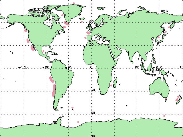
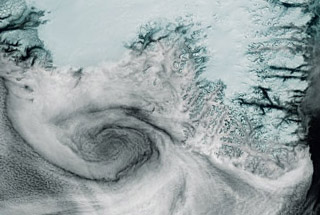
The phenomenon, which was tentatively called "coast vortex", can be observed
in the form of medium sized (20-150km) low cloud eddies over the water
in the frontier "sea-country".
During the observations of "coast vortex" phenomena it was noticed that
over the neighbouring country is nearly always clear. This could refer
to high pressure area.
It is (in cases of "coast vortex") not rare that the neighbouring country
has rather mountainous coast area.
The cause of the emergence "coast vortex" phenomena could
be the following.
In a high pressure area above a land (not rare - above a high land) the
mass of dry air sinks toward the earth's surface and flow finally apart.
There are hardly large convective cloud cells above the neighbouring sea
area.
If in this area the winds in the land direction occur, they force to move
the clouds in same direction.
However it is obstructed by conditions dominant over the country. The
eddy can appear by air friction.
It could be the other reason: cold land air masses heat up over the water
and rise.
The wind over the water affects the upward rise. The Coriolis Effect veers
the clouds into appropriate direction.
The phenomenon is to be observed rarely and only in certain
places with mostly more highly coastal area. Sometimes it occurs above
large bays, where developing eddies flows the coastal line around.
|