"Orographic Clouds" (OC)
 Orographic clouds develop in response to the forced lifting of air by the earth's topography (mountains for example). Orographic clouds develop in response to the forced lifting of air by the earth's topography (mountains for example).
Air passing over a mountain oscillates up and down as it moves downstream. If the air lifts upward and cools through expansion as it rises to its saturation temperature during this process, the water vapour within condenses and becomes visible as a cloud.
Upon reaching the mountain top, the air is heavier than the environment and will sink down the other side, warming as it descends. Once the air returns to its original height, it has the same buoyancy as the surrounding air. However, the air does not stop immediately because it still has momentum carrying it downward. With continued descent, the air becomes warmer than the surroundings and begins to accelerate back upward towards its original height. It is during the upper-most ascent phase of this cycle that clouds develop. In regions where air is descending, skies are clear.
The lifting of moist air can result in the generation of clouds, while lifting drier air may not produce any clouds at all. The oscillations continue as the air moves further downstream from the mountains but are eventually dampened out by mixing and friction.
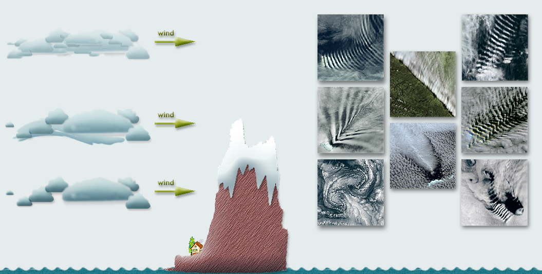
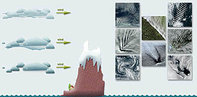
So to speak, the'Karman Vortex' Cloud Structure also belongs to the Orografic Clouds. Which cloud type is caused behind the barrier depends on the wind speed and on the wind layer height.
If the winds layer lies significantly lower than the height of the barrier, the "Karman Vortex 'Cloud Structure, or slipstream (cloudless area) can be developed behind this barrier.
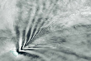
When the wind layer lies within the area of the height of the barrier, the so-called V-shaped clouds (with an Kelvin’s Limit Angle of 19°28') or banner clouds can grow behind this barrier.
Wenn the wind blows in the moist air layer, that lies higher than the barrier, then the strip-like cloud structures can be developed in the air rising areas. Such clouds width expands with distance from the barrier.
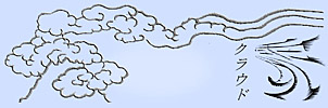
Banner clouds.
 They are frequently seen over the land, for example over the mountain ranges of the Andes, but also by lowering of the ice sheet in Greenland. They are frequently seen over the land, for example over the mountain ranges of the Andes, but also by lowering of the ice sheet in Greenland.
The possible explanation.
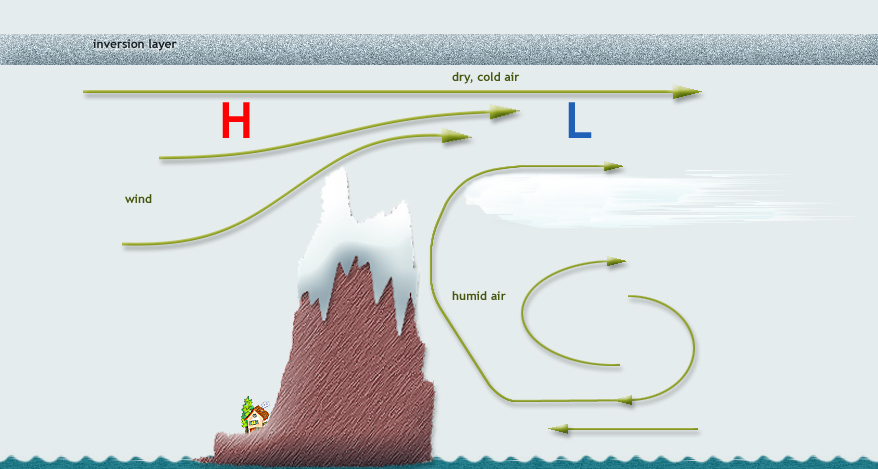
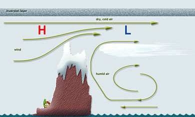
In the area of the hilltop, the distance between this summit and the inversion layer will be narrowed.
When the air flows above and around the summit with the sufficient speed, the wind speed increases, which will (according to Bernoulli's law) accompanied by a fall in pressure. The low pressure causes the air flow in the lee side of the barrier. When the air is humid, this leads to cloud formation. When the clouds come close to the air stream, which blows over the top, they will be swept away by its speed. The banner cloud stripes are formed.
If a lone mountain defies to the wind as an only obstacle, the air will flow around and over the obstacle. The pressure will fall again into the Lee side of the mountain. In that case, in stable conditions and at certain distance - it would be rare - the little "nest", can form the banner cloud in the shape of "Torch".
Orographic clouds are observed there, where the inversion layer is low enough, close to the island and mountain ridge. It can be found over Antarctica waters of (e.g. often in the Kerguelen Island area), on the northern Seas (e.g. often over of Aleutian Islands), over the Andes, over Greenland, etc. |