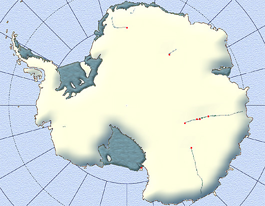
The Streets of Antarctica
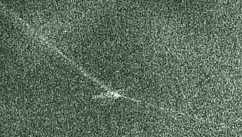
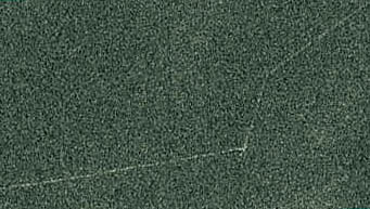
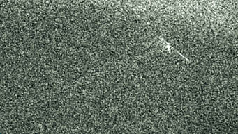
The points and lines displayed on the map below have been retrieved from the data of the Advanced Synthetic Aperture Radar.The images received from the ASAR contain thin light-coloured polygonal chains that are probably paths made in snow and ice by the transportation delivering all necessary equipment to the inland stations. These paths may be more than 1000 km in length. The stations can be detected in the pictures and look like small and comparatively bright spots on some vertices of polygonal chains or, more often, on their ends. The locations of the vertices of polygonal chains and stations may be confidently defined with accuracy ± 1km. |
 |
On the map below the vertices of polygonal chains are presented as blue points and possible stations or way camps are denoted as red squares.

|
|
 |
 |
 |
 |